
Polygon Consensus: Driving High-Precision GIS with Smart Crowdsourcing
998_Polygon consensus smart crowdsourcing for extracting building footprints from historical maps.
The paper introduces Polygon Consensus, a smart crowdsourcing algorithm designed to synthesize a single, accurate building footprint from multiple noisy, user-edited polygons. Developed for the New York Public Library's "Building Inspector" project, it achieves a high-quality consensus from historical insurance atlases.
TL;DR
The New York Public Library (NYPL) faced a massive bottleneck in digitizing historical building footprints. While crowdsourcing "fixes" for AI-generated errors helped, individual human effort was still inconsistent. This paper presents an algorithmic "Polygon Consensus" method that aggregates noisy user inputs into a single, high-fidelity polygon, boosting accuracy from 85% to 96% and significantly improving geometric alignment.
Problem & Motivation: The Human-in-the-Loop Bottleneck
Historical insurance atlases are a goldmine for urban historians, but their complex, hand-drawn nature makes automated extraction (Deep Georeferencing) notoriously difficult. The NYPL's Building Inspector project uses a semi-automatic pipeline:
- Computer Vision: Extracts initial (often broken) polygons.
- Crowd Verification: Users identify if a polygon is a "Fix."
- Crowd Editing: Multiple users manually move, add, or delete vertices to match the map.
The core problem is that humans are noisy. One user might simplify a corner, while another adds unnecessary vertices. How do we determine the "truth" when five different users give us five slightly different shapes for the same building?
Methodology: Vertex Voting and DBSCAN
The authors treat the consensus problem not just as an average of shapes, but as a topological voting problem.
1. Robust Vertex Clustering
The algorithm uses DBSCAN (Density-Based Spatial Clustering of Applications with Noise) to group vertices from different users that are "near" each other. This effectively identifies a "consensus corner."
2. The Voting Mechanism
Once clusters are formed, the algorithm looks at the edges. If a user drew an edge from a vertex in Cluster A to a vertex in Cluster B, that counts as a "vote" for a connection between those two clusters. The algorithm then traverses these clusters to find a cycle supported by the majority.
3. Pre-filtering Outliers
To prevent "vandalism" or low-quality edits from ruining the result, a pre-clustering step compares the centroids of all user polygons. If one user's polygon is far away from the rest, it is discarded before the vertex voting begins.
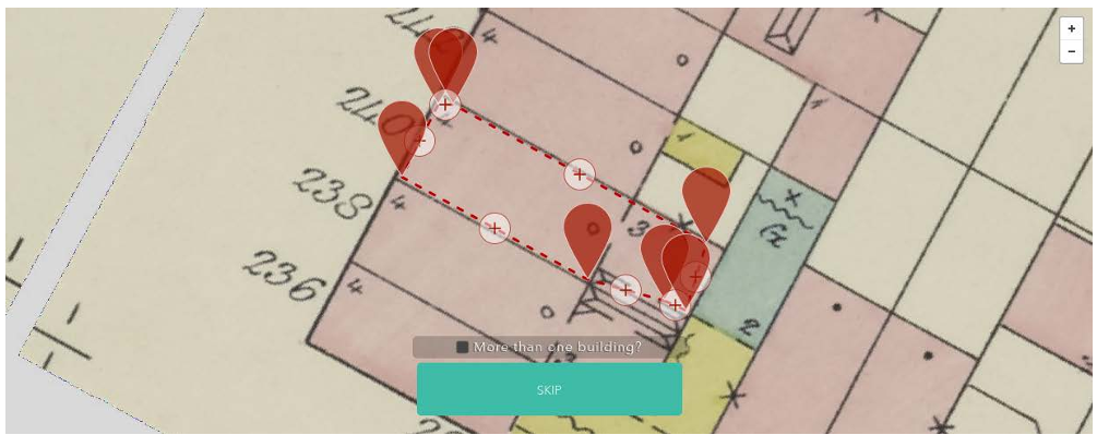 Figure 1: The Building Inspector interface where users "fix" polygons by manipulating vertices.
Experiments & Results: Better Than the Best User
The authors manually evaluated 1,878 polygons. The results were clear:
- Semantic Accuracy: While the best "random user" baseline hit 85%, the Polygon Consensus algorithm reached 96%.
- Geometric Precision: The authors measured the "darkness" of pixels under the polygon edges. Since buildings are drawn in ink, darker pixels indicate better alignment. The consensus polygons were consistently "darker" (0.44) than the average user-contributed polygon (0.49).
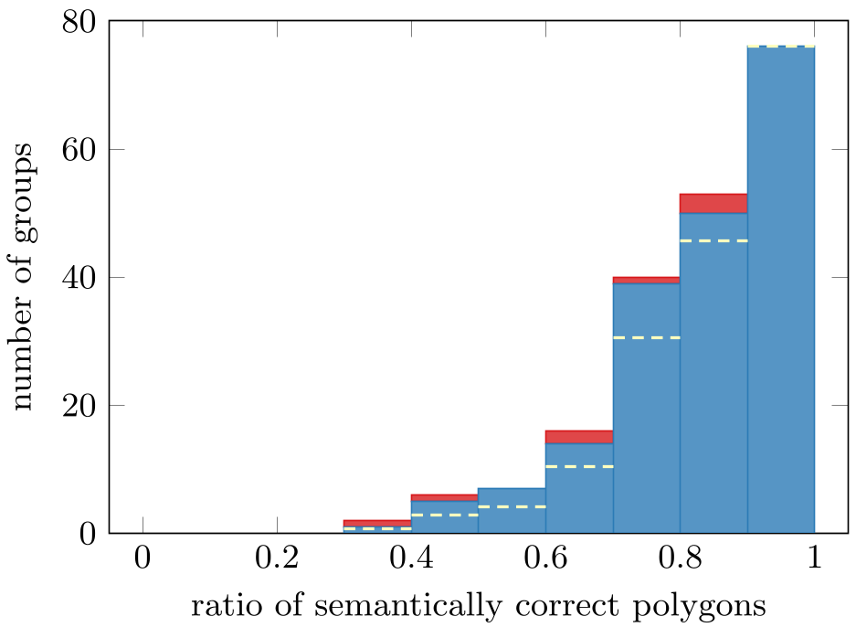 Figure 2: Examples of semantic correctness. A "correct" polygon must have exactly one vertex per corner.
Critical Analysis & Conclusion
Takeaway
The value of this work lies in "Smart Crowdsourcing." Instead of trying to find the "best" user, the system assumes everyone is slightly wrong and uses geometry to find the collective truth. This approach is essential for scaling digital humanities projects where expert labor is scarce.
Limitations
- Scale Dependency: The algorithm relies on the parameter (distance threshold). If the map scale changes drastically, must be manually tuned.
- Complex Topology: The current heuristic works best for simple cycles (building footprints). More complex structures (like courtyards or "donut" polygons) might require more advanced graph-search techniques.
Future Work
The authors suggest that picking automatically and defining polygon consensus as a formal optimization problem are the next logical steps. This work paves the way for "Deep Georeferencing," where historical maps are not just images, but searchable, semantic databases of our urban past.