
You Are AIRing Too Much: How Your Air Quality Sensor Is Leaking Your Precise Location
You are AIRing too Much: Assessing the Privacy of Users in Crowdsourcing Environmental Data
The paper introduces a novel location privacy attack on participatory air quality monitoring services, demonstrating that a malicious server can reconstruct user paths with high accuracy using only environmental data and coarse-grained cell tower IDs. By correlating fluctuations in temperature, humidity, and chemical readings (CO), the proposed algorithm achieves up to 97% precision in destination discovery.
TL;DR
Participating in a "privacy-friendly" air quality monitoring service might be giving away more than just pollution levels. Researchers have demonstrated that a malicious server can reconstruct your travel path and destination with up to 97% accuracy using only your coarse-grained cell tower location and environmental data like temperature and humidity. Even if you don't share your GPS, your environment speaks for you.
Background: The Illusion of Coarse Location
Participatory sensing is a powerful tool for smart cities, relying on individuals to collect data via mobile-connected sensors. To encourage participation, services often promise location privacy by only asking for "coarse-grained" data—identifying the cell tower you are connected to (approx. a 1km² area) rather than your exact GPS coordinates.
This paper challenges the security of this model, arguing that environmental data (Temperature, Humidity, CO levels) contains unique spatial-temporal signatures that act as a "side channel" for location tracking.
The Attack: Environmental Fingerprinting
The core insight is simple yet devastating: environmental conditions vary across a city in predictable ways. If an attacker has a "reference map" of these conditions, they can match the fluctuations in your data to the map.
1. The Metric of Detection
The authors define a "contraction" formula that focuses on fluctuations rather than absolute values. This allows the attack to work even if the user's sensor isn't perfectly calibrated compared to the attacker's reference sensors.
2. The Path Discovery Algorithm
The attacker builds a tree of possible paths within the 1km² cell tower zone.
- The Problem: The number of possible paths grows exponentially.
- The Solution: A Cut-off Mechanism. If a partial path already shows more environmental divergence than the "best" path found so far, the algorithm stops exploring that branch.
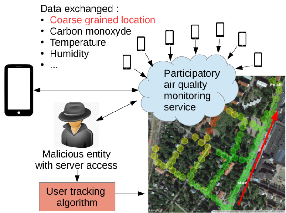 Fig 1. Illustration of the privacy attack: environmental data becomes the key to unlocking precise GPS paths.
Experimental Results: The Umbrella Effect
The researchers conducted tests in Helsinki, Finland, and Padova/Bassano, Italy, using "Sensordrones." One of their most interesting findings was the impact of outside conditions on privacy.
- Controlled vs. Uncontrolled: In Italy, sensors were protected by umbrellas (controlled), leading to clean data and 97% tracking accuracy. In Helsinki, sensors were exposed to direct sunlight (uncontrolled), which introduced noise and dropped the accuracy to 54.5%.
- The Multi-Metric Advantage: While Carbon Monoxide (CO) data was too volatile to track users effectively on its own, combining it with Temperature and Humidity allowed the attacker to reach high precision with very few samples.
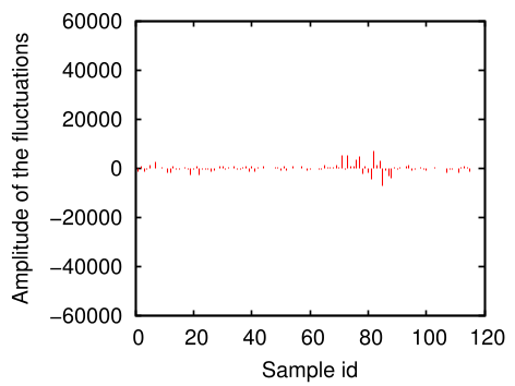 Fig 2. Combined sensor data (Temperature + Humidity + CO) significantly speeds up the attacker's ability to identify the correct path.
Critical Analysis: Why This Matters
The "Takeaway" is clear: Environmental data is a localization signal.
The study reveals a fundamental trade-off in crowdsensing:
- High-Quality Data: Better for science, but easier for attackers to track you.
- Noisy Data: Protects your privacy (unintentionally, via direct sunlight or sensor errors), but makes the monitoring service less useful.
Limitations
The attack assumes the server has access to a reference map of environmental conditions. In a real-world scenario, building this map might require the attacker to deploy their own sensors or use historical data, which might not always be up-to-date.
Conclusion
This work serves as a warning for the design of future IoT and Smart City applications. When we contribute "anonymous" data, we must consider the latent information within that data. To protect users, services must rethink how frequently they collect samples and perhaps adopt differential privacy—adding intentional noise to the sensor readings before they ever leave the user's smartphone.
Next time you check the air quality, remember: you might be sharing more than just the "air."