
PetaJakarta: Revolutionizing Flood Resilience through Self-Organizing Socio-Technical Systems
Citizen-Driven Flood Mapping in Jakarta: A Self-Organising Socio-technical System
This paper introduces PetaJakarta.org, a real-time flood mapping platform for Jakarta that transforms social media into a human-centric sensing network. Built on the open-source CogniCity engine, it creates a self-organizing socio-technical system that integrates Twitter feeds, citizen verification, and governmental response agencies to achieve SOTA disaster management efficiency.
TL;DR
PetaJakarta.org is a groundbreaking platform that turns Jakarta’s millions of Twitter users into a real-time, high-precision flood sensing network. By leveraging a self-organizing socio-technical system, it reduced emergency map update times from 6 hours to 20 minutes, proving that "smart citizens" are more vital than "big data" hardware for urban resilience.
Context: Why Traditional Smart Cities Fail
The "Smart City" paradigm often focuses on expensive, large-scale hardware deployments—thousands of physical sensors that are hard to maintain and lack the "on-the-ground" nuance of human experience. PetaJakarta.org flips this script. Jakarta, one of the world's most flood-prone and Twitter-active cities, served as the perfect "social laboratory" for a human-centric sensing approach.
The Problem: Information Lag and Noise
Before this project, the Jakarta Disaster Recovery Agency (BPBD DKI Jakarta) struggled with two main issues:
- Latency: Flood maps relied on manual reporting, taking hours to synthesize.
- Noise: Passive social media monitoring is full of irrelevant data. Just because someone tweets "#flood" doesn't mean they are reporting a current emergency at their location.
Methodology: Human-as-a-Sensor & CogniCity
The core of the system is a Self-Organizing Socio-Technical System (SOSTS). It doesn't require a proprietary app; it uses the ubiquitous Twitter interface.
The CogniCity Engine
The workflow follows a sophisticated "Harvest-Filter-Confirm" loop:
- Passive Harvesting: Accessing the Twitter "firehose" for flood keywords.
- Active Confirmation: The system (via
@petajkt) sends a real-time reply to the user, asking them to confirm the report and enable geo-location. - Visualization: Verified data is instantly mapped on a public web-based community map for both citizens and government agencies.
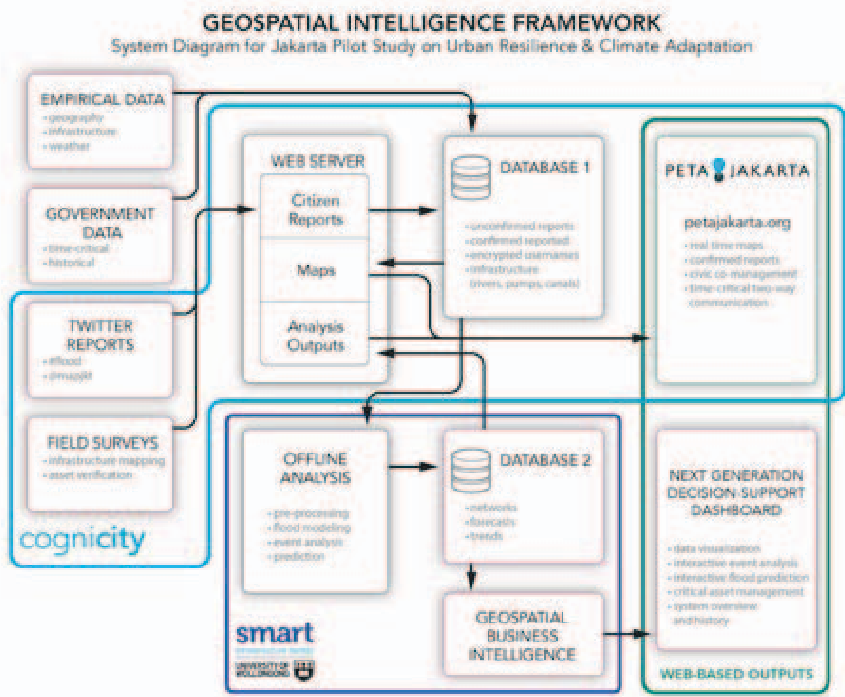 Figure 1: The open-source CogniCity architecture facilitating information flow.
Computational Justice: The Ethical Framework
The researchers didn't just build a tool; they applied the framework of Computational Justice to ensure the system’s sustainability. This involves:
- Distributive Justice: Ensuring that the information shared by a few benefits the many.
- Procedural Justice: Keeping the system open-source and transparent.
- Interactional Justice: Treating users fairly—for instance, if a user ignores a confirmation request once, they aren't spammed again.
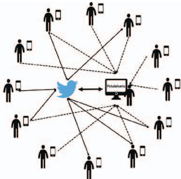 Figure 2: The complex interplay between citizens, technology, and government actors.
Results & Impact
The performance metrics from the 2014/2015 flooding season are staggering:
- Speed: Map updates were slashed by over 94%.
- Engagement: While 100,000 tweets were harvested, the "confirmation" process filtered these down to 2,000 high-accuracy reports, eliminating social noise.
- Reach: The map received 69,000 hits, becoming a vital public utility.
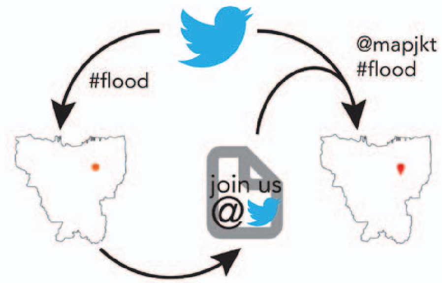 Figure 3: The "Tweet-Back" mechanism used to verify citizen data.
Depth Insight: The "Free-Rider" Challenge
One fascinating takeaway from the study is the "retributive justice" gap: 69,000 people used the data, but only 2,000 actively contributed. In socio-technical systems, managing this "free-rider" problem is essential to prevent contributor burnout. The authors suggest that future success relies on moving from "passive users" to "prosumers" through targeted engagement.
Conclusion & Future Work
PetaJakarta.org demonstrates that urban resilience is a socio-technical challenge, not just a computational one. By treating citizens as intelligent nodes in a network rather than just data points, we can create agile, low-cost infra-systems. The next phase? Integrating automated sensors and drones to complement human intelligence, creating a truly hybrid resilience network.