
CrowdLIM: Turning Citizen Snapshots into Structural Health Sentinels
CrowdLIM: Crowdsourcing to enable lifecycle infrastructure management
The paper introduces CrowdLIM, a framework that utilizes citizen science and crowdsourced images (CIMs) for the lifecycle management of civil infrastructure. By integrating Structure-from-Motion (SfM) and automated image localization, the system filters irrelevant visual noise to extract high-precision Regions-of-Interest (ROIs) for structural health monitoring.
Executive Summary
TL;DR: CrowdLIM is a pioneering framework that repurposes everyday "tourist photos" (Crowdsourced IMages or CIMs) for the long-term monitoring of civil infrastructure. By bridging the gap between chaotic public photography and rigorous engineering requirements through Structure-from-Motion (SfM), it allows engineers to extract localized views of structural components without setting foot on-site.
Positioning: This work moves beyond traditional "expert-centric" vision monitoring (drones/fixed cameras) into the realm of Citizen Science, establishing a scalable, low-cost model for infrastructure lifecycle management.
The "Data Gap" in Infrastructure Management
Monitoring a bridge or a tower over 50 years is a logistical nightmare. While vision-based methods (CNNs, etc.) are powerful, they require high-quality, consistent data. Currently, we face a paradox: thousands of photos of landmarks are uploaded to social media daily, yet engineers still fly expensive drones because public photos are "too noisy," lack orientation data, or simply focus on the wrong things (like people standing in front of the structure).
The authors' insight is simple yet profound: If we can mathematically map a chaotic photo to a precise 3D coordinate on a structure, the "noise" becomes irrelevant.
Methodology: From Chaos to ROI
The CrowdLIM workflow functions in three distinct phases:
- The Baseline Anchor: Before any crowdsourcing begins, a one-time "Robust Baseline Model" (3D Point Cloud) is created using high-quality DSLR and drone imagery. This acts as the geometric "source of truth."
- CIM Acquisition: The framework utilizes both passive (social media scraping) and active (targeted competitions/web portals) engagement. In the case study, they leveraged Purdue University graduations to gather hundreds of images.
- Automated Localization: This is the technical heart. Using iterative feature matching, every new CIM is "registered" against the baseline. By calculating the Projection Matrix (P), the system knows exactly where the camera was and what it was looking at, allowing it to "crop" the image to focus solely on Target Regions of Inspection (TRIs).
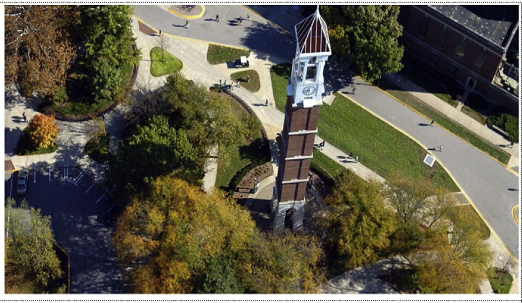 Figure 1: The CIM registration process where 2D features from public photos are matched to 3D descriptors in the baseline model.
Real-World Validation: The Purdue Bell Tower
The authors tested CrowdLIM on the 160 ft Purdue Bell Tower over two years. The results were categorized into three scenarios:
- Monitoring: Tracking damage-sensitive columns (TRI 1).
- Forensics: Tracing a newly discovered crack back through historical photos (TRI 3).
- Evolution: Monitoring the growth of a known crack detected in mid-2017 (TRI 2).
Key Experimental Statistics:
| Metric | Quantitative Result |
|---|---|
| Total CIMs Collected | 455 |
| Registration Success Rate | 50.32% |
| ROIs Extracted | 231 (across 3 TRIs) |
| ROI Processing Time | < 2 seconds per image |
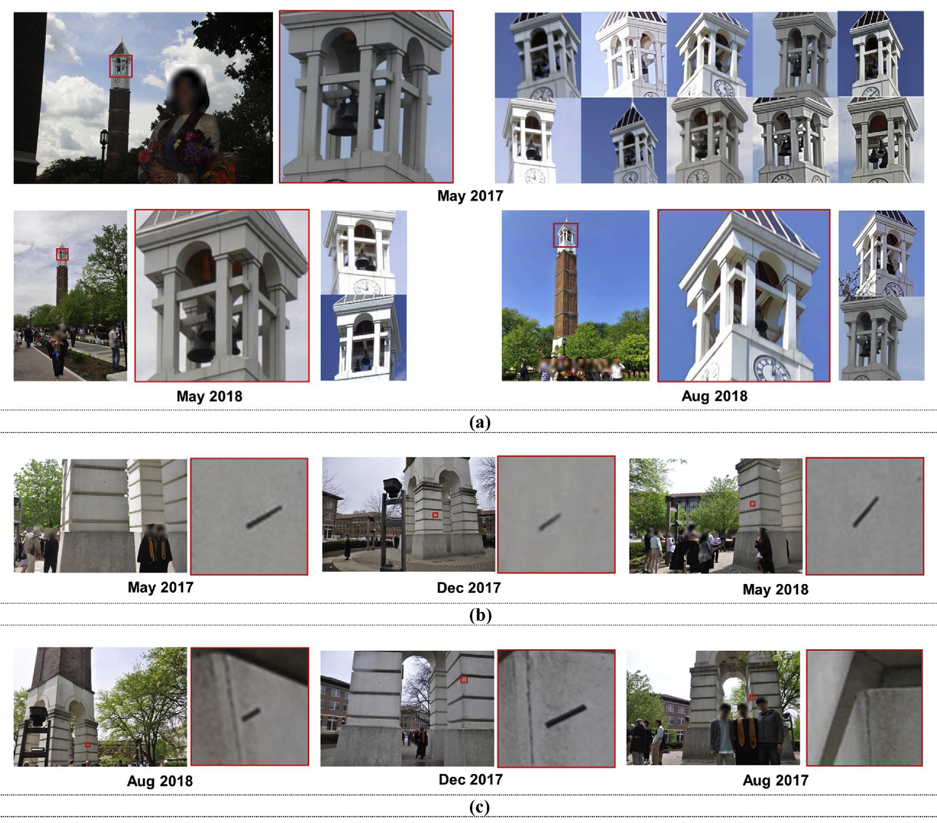 Figure 2: Successful ROI extractions showing how a single landmark photo can be accurately cropped to monitor small-scale surface cracks.
Critical Insights & Future Outlook
The "Time Machine" Effect: Perhaps the most significant advantage of CrowdLIM is its ability to perform backward tracking. If a crack is found today, an engineer can define a new TRI and instantly extract five years' worth of historical views from existing crowdsourced databases to see exactly when the failure started.
Limitations:
- Registration Sensitivity: The 50% success rate highlights the difficulty of matching photos with heavy "temporary" features (like trees with leaves vs. bare branches).
- Occlusion: Crowdsourced photos often have people or objects blocking the view, requiring further filtering.
Conclusion: CrowdLIM effectively democratizes infrastructure sensing. It proves that with the right geometric constraints, our social media habits can unknowingly contribute to the safety and longevity of our cities' landmarks.