
Precise Indoor Mapping: Eliminating PDR Drift via Bidirectional Track Fusion
A Crowdsourcing based Indoor Topology Construction Algorithm using the Forward and Backward Track Fusion of User Closed Trajectory
This paper introduces a crowdsourcing-based indoor topology construction algorithm that leverages forward and backward track fusion of closed-loop user trajectories. By combining bidirectional Pedestrian Dead Reckoning (PDR) with multi-strategy heading estimation and magnetic fingerprint clustering, the system achieves a high-precision mapping accuracy of 0.40 meters.
TL;DR
Indoor Location-Based Services (LBS) are often bottlenecked by the lack of accurate maps. This paper presents a novel crowdsourcing approach that solves the "drifting trajectory" problem in Pedestrian Dead Reckoning (PDR). By requiring users to walk in closed loops and fusing the resulting data in both forward and backward time-steps, the researchers achieved a remarkable mapping accuracy of 0.40 meters using only standard smartphone sensors.
The Drift Dilemma: Why Your Phone Can't Map Indoors
Standard indoor mapping via crowdsourcing usually relies on PDR—using accelerometers to count steps and gyroscopes/compasses to determine direction. However, PDR has a fatal flaw: Cumulative Error. Because each step is calculated based on the previous one, even a tiny 1-degree error in heading eventually leads to a trajectory that "drifts" far away from reality.
Existing solutions like CrowdInside or MapGENIE try to use "anchors" (like elevators or stairs) to reset this error. But what if the building lacks these features? This paper suggests that the solution isn't just about where you walk, but how you process the path.
The Core Innovation: Closed-Loop Bidirectional Fusion
The researchers introduce a simple yet brilliant constraint: The Closed Loop. Users are asked to start and end their data collection at the same physical point.
1. Bidirectional PDR
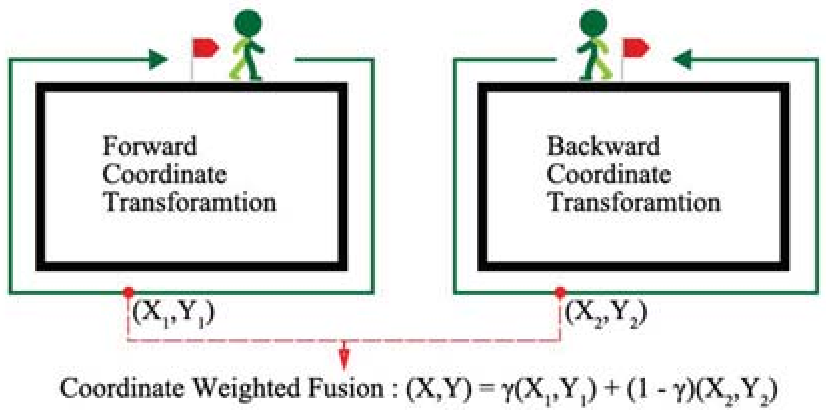
Instead of just calculating the path from Start → End, the system performs a dual calculation:
- Forward Path: Standard PDR from step 1 to .
- Backward Path: Reversing the data sequence and calculating from step back to 1.
The magic happens in the Weighted Fusion. Since PDR error is lowest at the start of a sequence, the "Forward" path is trusted more near the beginning, while the "Backward" path (which treats the original endpoint as its accurate start) is trusted more near the end.
2. Intelligent Heading Estimation
To combat magnetic interference (metal beams, electronics), the authors didn't just rely on the compass. They used:
- Radial Gaussian Filtering: To smooth out compass noise.
- Multi-strategy Fusion: Comparing gyroscope and compass values. If the compass jumps but the gyro is stable, the system ignores the compass "glitch."
Methodology: From Raw Sensors to Topology
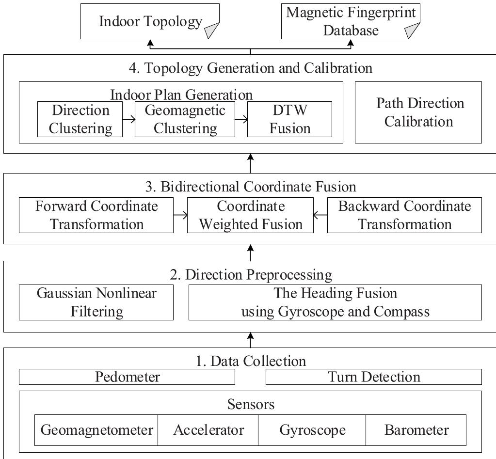
The system architecture follows a robust pipeline:
- Data Collection: 100Hz sampling of IMU and Geomagnetic data.
- Direction Processing: Fusing gyro/compass data to get stable "Atomic Paths" (straight lines between turns).
- Bidirectional Fusion: Calculating coordinates using the weighted formula:
- Clustering & Merging: Using Affinity Propagation (AP) to group similar trajectories and Dynamic Time Warping (DTW) to merge them into a single, clean topological map.
Experimental Results
The team tested the algorithm at the Chinese Academy of Sciences (7th & 8th floors).
- Accuracy: The average error was reduced to 0.40m.
- Efficiency: The offline reconstruction took about 96 seconds—perfectly acceptable for map maintenance.
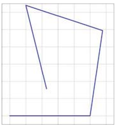
- Visual Evidence: As shown below, the weighted fusion (c) aligns perfectly with the starting point compared to the drifting unidirectional paths (a and b).
Critical Analysis & Future Outlook
Why it works: By treating the trajectory as a bridge between two fixed points (the start and the end of the loop), the math effectively "squashes" the cumulative error from both sides.
Limitations:
- User Cooperation: It requires users to follow a specific "closed-loop" behavior, which might not always happen naturally in "passive" crowdsourcing.
- Floor Detection: While the paper mentions barometers for floor division, complex multi-level transitions (like ramps) remain a challenge.
Future Work: The authors aim to integrate SLAM (Simultaneous Localization and Mapping) and visible light positioning to further refine initial positions and handle global coordinate transformations.
Summary
This work proves that we don't need expensive LiDAR or dense Wi-Fi beacons to map the indoors. By simply changing the "geometric logic" of how we process IMU data, we can turn a drifting smartphone trace into a professional-grade topological map.