
Crowdsourcing Landforms: Bridging the GIS Gap with Algorithmic Hints
Crowdsourcing Landforms for Open GIS Enrichment
The paper introduces a hybrid framework to enrich OpenStreetMap (OSM) with mountain landform data by combining heuristic processing of Digital Elevation Models (DEM) with expert crowdsourcing. It targets the improvement of the PeakLens AR application and the SnowWatch monitoring system by identifying missing peaks and validating existing metadata.
TL;DR
Researchers from Politecnico di Milano have developed a hybrid workflow to solve the "missing data" problem in OpenStreetMap (OSM). By using NASA's Digital Elevation Models (DEM) to "guess" where mountain peaks should be, they provide specific hints to volunteers via a 3D interface called MapMyMountains. This targeted crowdsourcing turns vague volunteering into precise data validation, significantly improving environmental monitoring capabilities.
Problem & Motivation
Open GIS platforms like OpenStreetMap are revolutionary, but they are only as good as their contributors. While cities are well-mapped, remote mountainous regions remain "dark." In Canada, for instance, OSM contains only 60% of the peaks listed in governmental records.
The authors identified two major roadblocks:
- Data Incompleteness: Over half of the existing peaks in OSM lack basic metadata like elevation or nomenclature.
- Volunteer Fatigue: It is difficult for a volunteer to know where to start mapping in a vast mountain range.
Their insight? Provide the crowd with algorithmic candidates. Instead of asking "Find a mountain," they ask "An algorithm thinks there is a peak here—can you confirm it?"
Methodology: The Machine-Human Loop
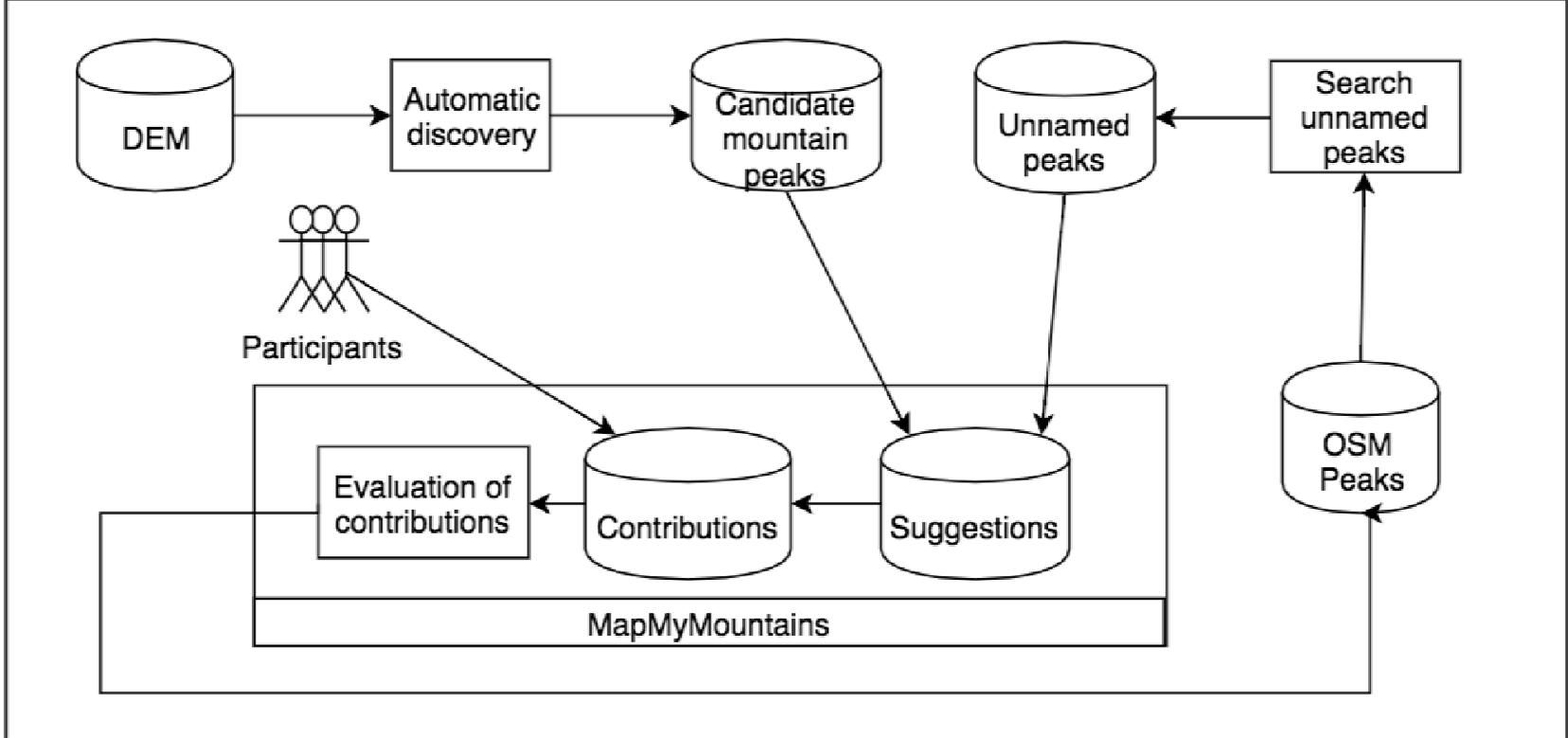
The methodology functions as a semi-automated pipeline that bridges low-level physical data with high-level semantic labels.
- Automatic Discovery: The system processes NASA SRTM (Shuttle Radar Topography Mission) data. Using morphometric heuristics (analyzing slopes and curvature), it identifies candidate peaks globally.
- Filtering & Matching: These candidates are spatially joined with OSM nodes. If a candidate is far from any existing OSM peak, it is flagged as a "missing peak."
- Crowd Validation: These high-uncertainty points are pushed to the MapMyMountains platform.
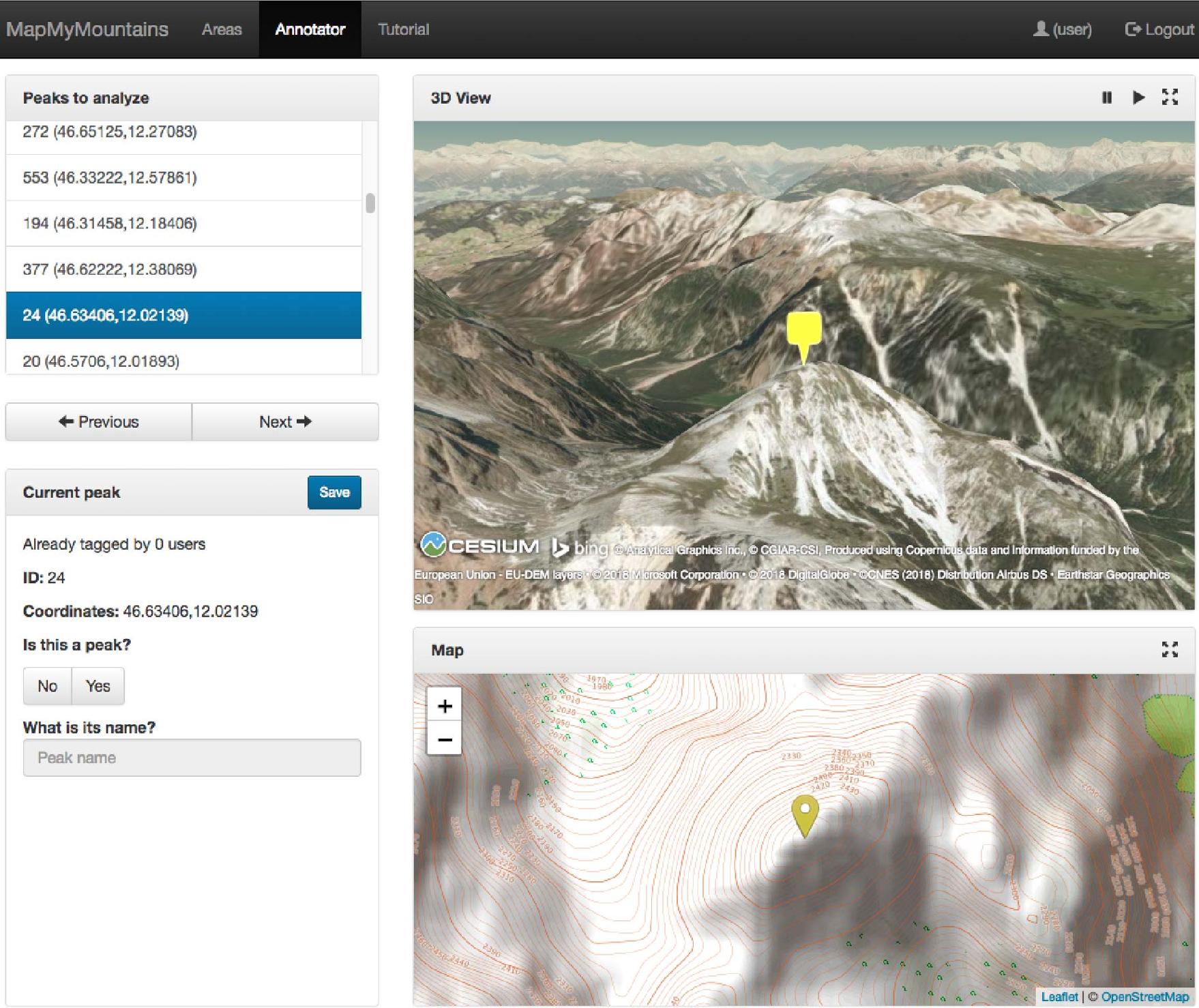
The user interface (UI) is designed to minimize cognitive load by offering a side-by-side 2D/3D view, allowing non-experts to visually verify if a "peak" exists based on terrain rendering.
Experiments & Results: Mapping the Unmapped
The paper performs a rigorous assessment of OSM global data. Out of over 500,000 mountain nodes:
- 48.74% have both name and elevation.
- 11.57% are essentially "ghost nodes" with neither name nor elevation.
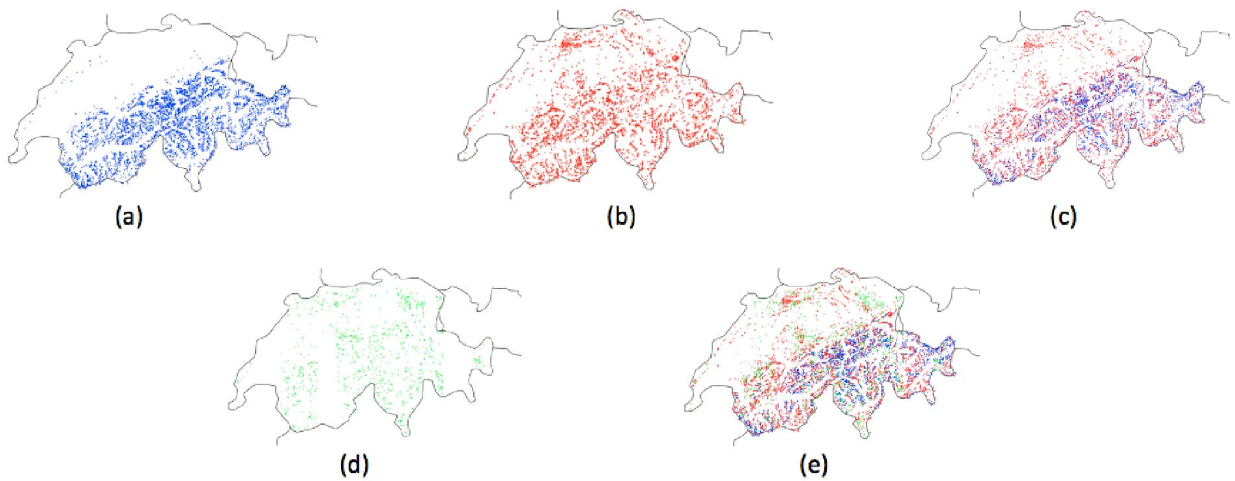
In a case study focused on Switzerland, even in a region with dense GIS data (combining OSM and the swissNAMES3D dataset), the authors' DEM-based discovery found 1,156 candidate peaks that were missing from both authoritative and crowdsourced sources.
Furthermore, the study confirmed that DEM elevation data is highly reliable, with 95% of the data points showing an error margin of less than 65 meters compared to human-mapped OSM data, making it a robust baseline for correcting existing errors.
Critical Analysis & Conclusion
Takeaway
The true value of this work lies in its In-Itinere (during the process) evaluation philosophy. By using heuristics to detect "uncertainty," the system steers human effort toward the most needed areas (Maximum Utility), rather than redundant mapping of popular tourist spots.
Limitations & Future Work
While effective, the current peak-matching algorithm uses a simple distance threshold. In complex ridges, this might lead to duplicate peaks being identified as new candidates. The authors plan to integrate more sophisticated terrain features (slope/prominence) and gamification—rewarding users with leaderboards—to ensure long-term engagement within the PeakLens app community.
This framework proves that for specialized environmental GIS, the future is not just "human" or "AI," but a hybrid architecture where algorithms provide the "where" and humans provide the "what."