
Architecting Resilience: Designing VGI Systems for Real-Time Disaster Response
14506_Design and development of a crowdsourcing mobile app for disaster response.
This paper presents a robust architecture for a Volunteered Geographic Information (VGI) mobile crowdsourcing application designed specifically for disaster response. The system integrates a backend server database with a streamlined client-side mobile interface to facilitate real-time spatial data collection and management by volunteers during emergencies.
TL;DR
This research addresses the critical need for timely spatial data during emergencies by proposing a specialized architecture for Volunteered Geographic Information (VGI) via mobile crowdsourcing. By decoupling robust backend spatial databases from streamlined client interfaces, the system enables citizen-led data reporting that is both reliable and scalable.
Problem & Motivation: The Information Gap in Crises
In the wake of a disaster, traditional top-down geographic information systems often fail to capture localized, rapidly changing conditions—such as blocked roads or community needs—fast enough. The primary bottleneck is the "data latency" inherent in official channels.
The authors identify a clear gap: while billions of people possess smartphones capable of being "distributed sensors," there is a lack of specialized, resilient architectures that can handle the influx of unverified, noisy spatial data while remaining simple enough for a panicked user to navigate.
Methodology: The Architecture for Crowdsourcing
The paper proposes a dual-component architecture designed to maximize data integrity and user engagement.
1. Backend & Server Database
The core of the system is the backend architecture, which manages data persistence, user authentication, and spatial indexing. This ensures that every coordinate reported by a volunteer is correctly mapped to a global coordinate system and can be queried in real-time by emergency responders.
2. Client-Side Mobile Design
The client-side focuses on reducing cognitive load. Recognizing that disaster scenarios are high-stress, the interface is optimized for rapid input, leveraging GPS sensors and simple iconography to facilitate data capture without requiring deep GIS expertise.
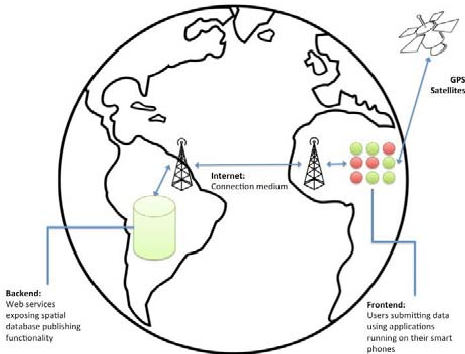 Figure 1: High-level overview of the proposed VGI mobile architecture and data flow.
Experiments and Design Evaluation
The research evaluates the architecture through its ability to maintain data flow from the field to the central server. The integration of mobile-specific components ensures that even under limited bandwidth, critical spatial attributes are prioritized for transmission.
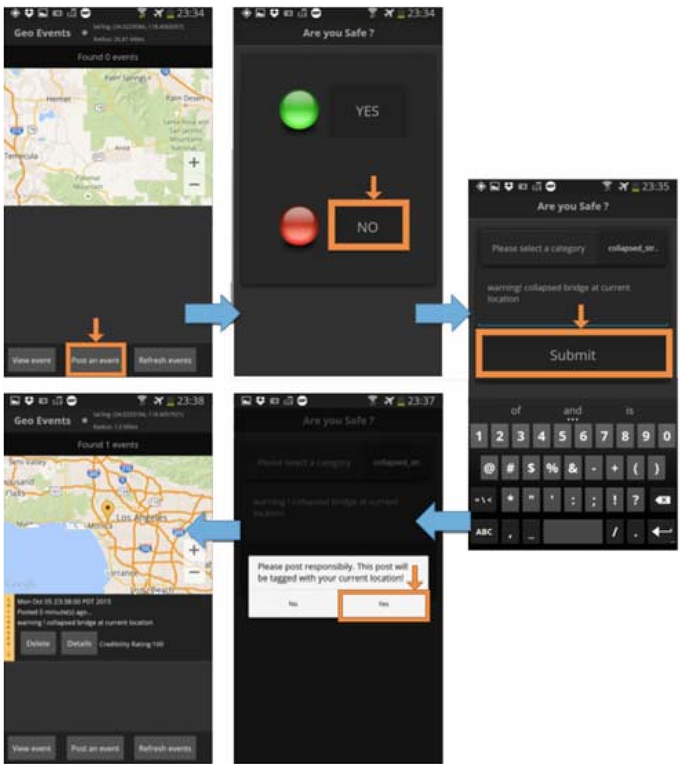 Figure 2: Interaction between the mobile client and the spatial database schemas.
Key findings include:
- Scalability: The backend separation allows for horizontal scaling as more volunteers join the network.
- Usability: The design reduces the "Time-to-Report," a critical metric for first responders who rely on the most current data.
Critical Insight & Conclusion
This paper serves as a blueprint for modernizing disaster management through citizen science. The move from passive data consumption to active Volunteered Geographic Information is not just a technical challenge but an architectural one.
Limitations: While the architecture is sound, the paper does not extensively cover data verification—the problem of "malicious or incorrect reports" remains an open area for research.
Forward-Looking: As we move toward 2026 and beyond, integrating automated AI validation layers atop this backend could further filtered noise, making VGI the gold standard for real-time situational awareness.