
Disasters Through the Lens: Turning Flickr Users into Global Reconnaissance Sensors
Disasters seen through Flickr cameras
This paper introduces a methodology for disaster reconnaissance by treating Flickr users as "mobile sensors" through their geo-tagged photos and metadata. Using a burst detection algorithm and "interestingness" measures for tags, the system identifies event occurrences and visualizes the aftermath of disasters like the 2011 Tohoku earthquake and the Tuscaloosa tornado.
TL;DR
Can we use vacation photos to save lives? This research demonstrates a systematic framework to transform the millions of geo-tagged images on Flickr into a real-time disaster reconnaissance tool. By detecting "bursts" of activity and analyzing "interesting" tags, the authors successfully mapped major catastrophes like the 2011 Tohoku Tsunami and Alabama tornadoes with remarkable precision.
Academic Positioning: This work bridges the gap between traditional GIS (Geographic Information Systems) and social media analytics, moving beyond text-based analysis (like Twitter) into the richer, visual domain of "Human Sensing."
The Problem: The "Blind Spot" in Disaster Response
When a disaster strikes, the first few hours are critical. Satellite imagery is often the go-to resource, but it has limitations: clouds can block the view, and the resolution often fails to show the specific structural damage needed for ground rescue. Manual reconnaissance teams, on the other hand, are slow and limited in number.
The authors identified that Flickr, a massive repository of geo-tagged imagery, contains latent "snapshots" of history as it happens. The challenge is filtering the signal from the noise: how do you distinguish a local wedding from a catastrophic earthquake?
Methodology: Mining the Human Sensor
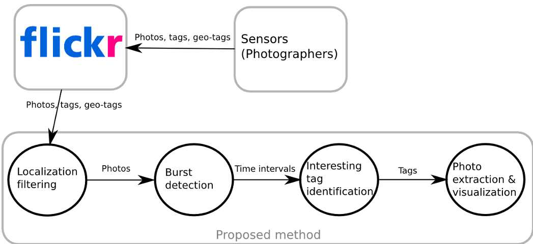
The authors treat every Flickr user as a mobile sensor. Their methodology follows a four-step pipeline:
- Localization Filtering: Targeting specific coordinates.
- Burst Detection: Using Kleinberg’s algorithm to find sudden spikes in user activity. Instead of counting total photos (which can be biased by one person taking 100 shots), they count "Activated Sensors"—unique users posting on a given day.
- Burst Characterization: Using a statistical "interestingness" formula to find tags that are unique to the event (e.g., "tsunami," "relief," "quake").
- Visualization: Mapping these photos onto Google Maps and comparing them with Google Street View to assess "Before vs. After" damage.
Key Insight: Magnitude vs. Sentiment
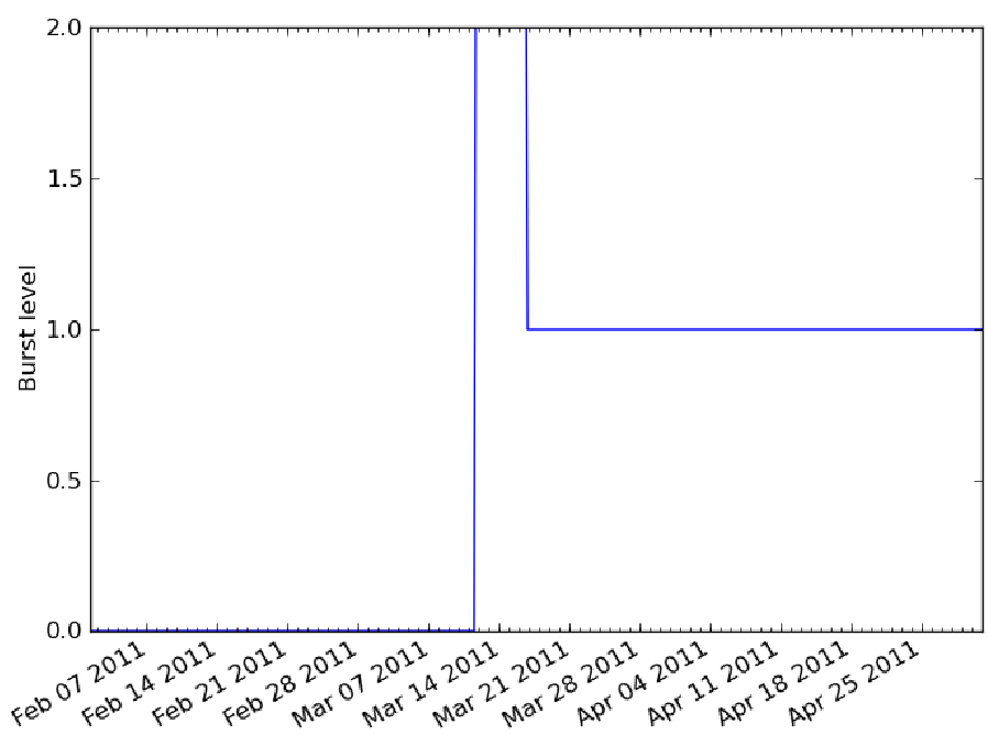
A fascinating finding in the paper is how "Human Sensing" differs from physical sensors. In Osaka, where the 2011 earthquake was felt mildly, no burst was detected. However, in Tokyo, a massive burst was recorded, alongside a second burst for Cherry Blossom Viewing (Sakura).
This reveals that Flickr records what is impressive to humans. In Miyagi, despite the cherry blossoms blooming, there was no "Sakura" burst—users were entirely focused on the tsunami aftermath. This prioritization of data based on human urgency is a unique advantage of social sensing.
Experiments & Results
The system’s accuracy was tested on two major 2011 events:
1. The Tohoku Earthquake and Tsunami
The system detected the earthquake in Tokyo within minutes. More importantly, it highlighted the connectivity lag. In the devastated Miyagi prefecture, only 7% of photos were uploaded the same day due to power outages, but by day 6, 65% were available—creating a secondary "reconnaissance wave" for long-term recovery planning.
2. The Tuscaloosa Tornado
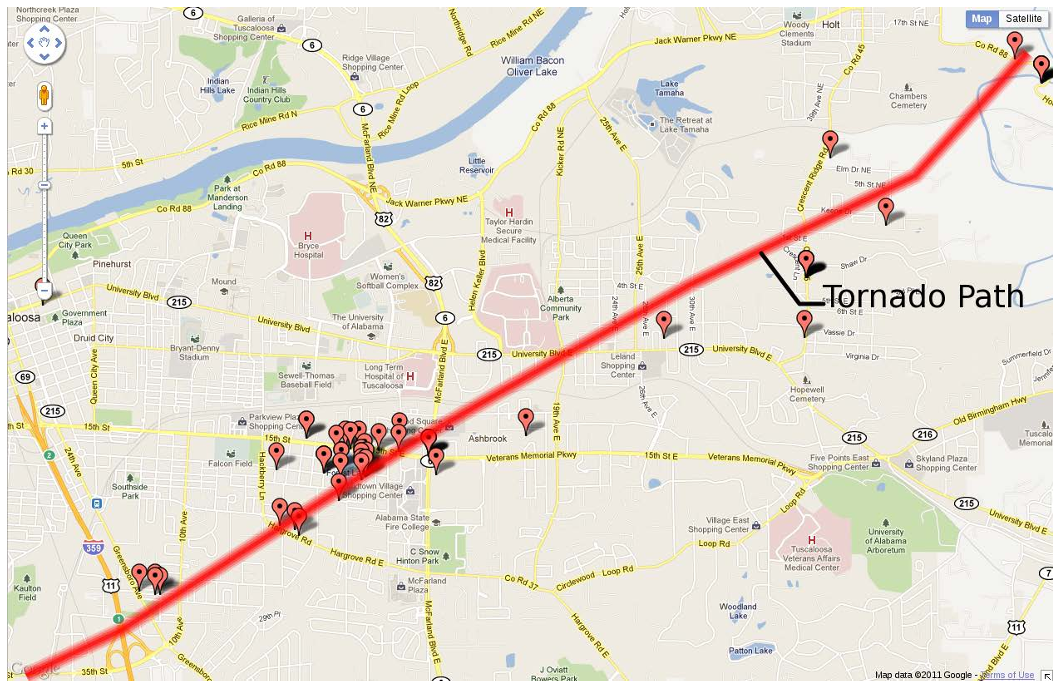
While an earthquake impacts a whole country, a tornado is a local "path." The methodology proved its precision here, successfully plotting markers that perfectly traced the physical path of the tornado through the city of Tuscaloosa.
Takeaways & Future Outlook
The value of this research lies in its Inductive Bias: it assumes that human attention is the best filter for identifying significant environmental changes.
Limitations:
- Latency: As seen in Miyagi, physical infrastructure damage delays the "sensor" data.
- Demographics: The data is limited to populations that use Flickr (typically hobbyist photographers).
Future Work: Integrating this temporal burst detection with modern Computer Vision (CNNs/Transformers) could allow autonomous systems to not just "find" photos of a disaster, but to "quantify" the damage (e.g., "House destroyed" vs. "Flooded") automatically.
Conclusion: This paper proves that in the age of global connectivity, every camera is a potential tool for emergency response. By looking through the "eyes" of the public, responders can see the world as it breaks, and as it heals.