
Space-Based Conservation: Automating Hippo Censusing via Multispectral Satellite Imagery
Estimating the Population of Large Animals in the Wild Using Satellite Imagery: A Case Study of Hippos in Zambia’s Luangwa River
This paper presents a feasibility study on using fine-resolution commercial satellite imagery (Maxar WorldView) to automate the population estimation of hippos in Zambia’s Luangwa River. By leveraging 8-band multispectral data and the GENIE (Genetic Imagery Exploitation) machine learning framework, the researchers successfully established a spectral and spatial signature for detecting hippos in riverine environments.
TL;DR
Monitoring the world’s largest hippo population in Zambia’s Luangwa Valley is moving from dangerous low-altitude flights to the "ultimate high ground." This research demonstrates a viable machine learning workflow using Maxar WorldView satellite imagery to detect and count hippos by exploiting their unique 8-band multispectral signatures, overcoming the challenges of partial submersion and low pixel counts.
Background Positioning
This study is a critical "proof-of-principle" work in the field of Satellite Remote Sensing (SRS) for Conservation. It bridges the gap between traditional ecology (manual counting) and automated computer vision, specifically addressing the "needle in a haystack" problem of identifying small targets in complex aquatic corridors.
Problem & Motivation: The Danger of the Status Quo
Accurate wildlife counts are vital for managing human-wildlife conflict and environmental stressors like anthrax. Historically, Zambia relied on professional pilots for aerial counts. However, this is fraught with issues:
- Operational Risk: Flying low over rivers during the dry season is hazardous due to dense bird populations.
- Scale & Cost: Small planes have limited range and a high carbon footprint.
- Visual Ambiguity: Hippos are "semi-aquatic ghosts"—their submerged bodies look nearly identical to river rocks or muddy logs in standard RGB imagery.
The research intuition here is that while a hippo might look like a rock in the visible spectrum, its biological skin properties offer a distinct signature in multispectral bands that satellites can capture from 600km above.
Methodology: Mining the Spectral Signature
The core innovation lies in moving beyond simple shape detection to Spectral Disambiguation.
1. Spectral Fingerprinting
The researchers analyzed WorldView's 8-band data. While a hippo out of water covers ~60 pixels, a submerged one drops to <30. However, by plotting the mean surface reflectance across the 8 bands, they found a persistent "delta" between hippos and water.
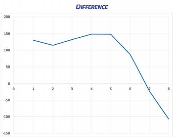 Figure: The mean spectra for hippos vs. river water. Note the distinct separation across the 8-band multispectral range.
2. GENIE: Evolutionary Machine Learning
Instead of manually tuning filters, the team used GENIE (Genetic Imagery Exploitation). This tool uses evolutionary algorithms to "breed" the most effective image processing pipeline. It searches through thousands of combinations of spatial and spectral operators to find the one that best fits the human-provided "training paint" (examples of hippo pixels).
Experiments & Results
The feasibility test focused on the Luangwa River during the dry season (June–September), when hippos are most concentrated.
- Spatial Sufficiency: With a GSD of ~40cm, the imagery successfully resolved individual animals within pods.
- Classifier Performance: The GENIE-trained model showed high visual agreement with ground truth data. By thresholding the Euclidean distance of pixels from the "ideal hippo spectrum," the system could effectively mask out the river and highlight the animals.
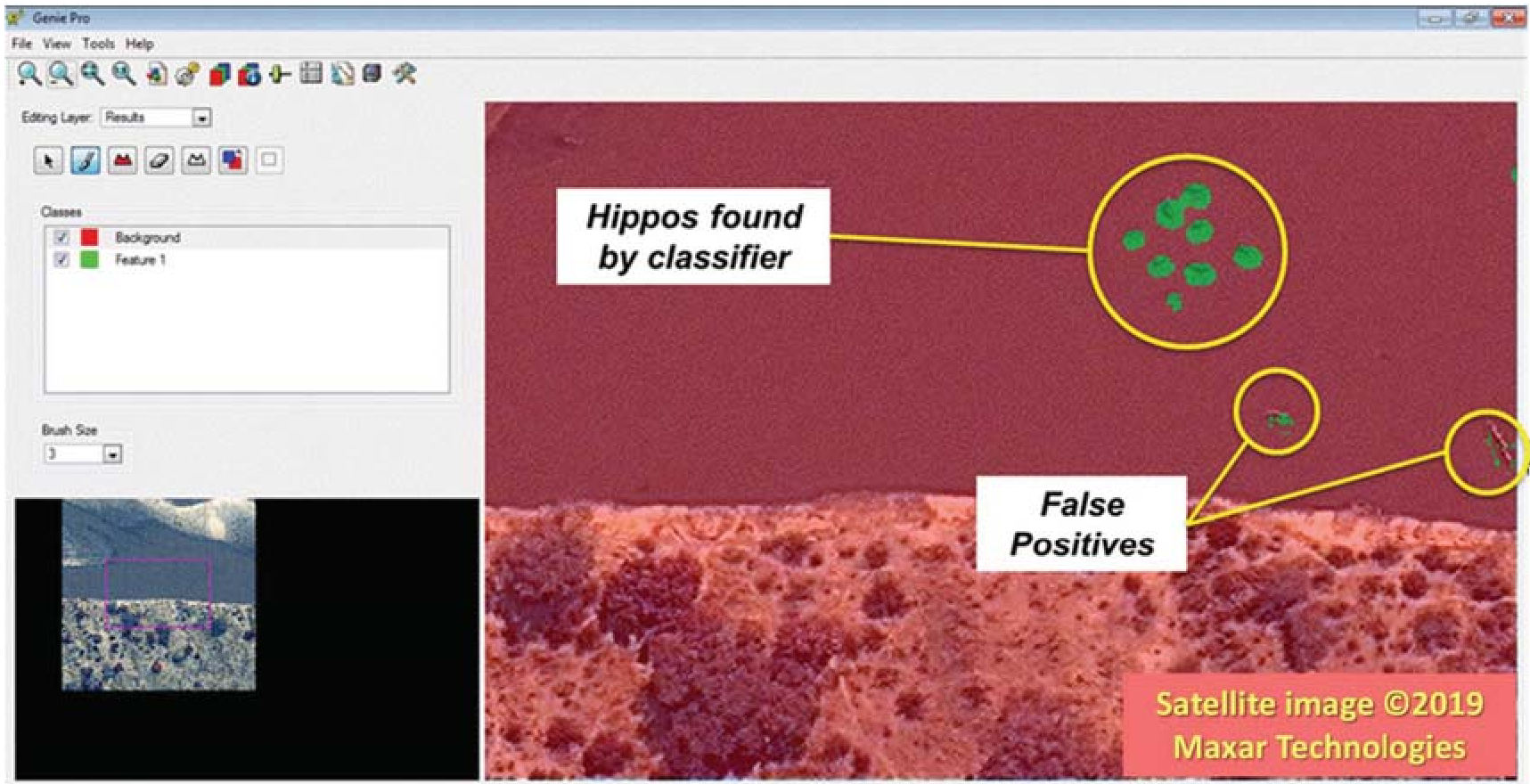 Figure: The application of the GENIE classifier to detect hippo clusters along the riverbank.
Critical Analysis & Conclusion
Takeaway
The transition to satellite-based censusing is no longer a luxury but a necessity for large-scale conservation. This paper proves that even with limited "pixels on target," multispectral data provides enough Inductive Bias to distinguish biological targets from environmental noise.
Limitations
- Search Area: While hippos are river-bound, extending this to wide-ranging land animals (like elephants) would exponentially increase "False Positives" due to the variety of land-based background materials (dry grass, shadows, etc.).
- Canopy Obscuration: The method relies on a clear line of sight. Animals under forest cover remain invisible to this specific optical approach.
Future Outlook
As we move toward 2026, the integration of Synthetic Aperture Radar (SAR) with multispectral optical data might allow for monitoring hippos even through cloud cover or at night, providing a 24/7 "guardian in the sky" for Africa’s watersheds.