
OBSC: Infusing Spatial Data Mining with Formal Ontology for Natural Result Discovery
Using Formal Ontology for Integrated Spatial Data Mining
The paper proposes an Ontology-Based Spatial Clustering (OBSC) framework that integrates formal ontologies into spatial data mining. It leverages domain and task ontologies to customize existing algorithms, specifically achieving SOTA-level "natural" results in traffic accident hot spot detection.
Executive Summary
TL;DR: This paper tackles the "blindness" of traditional spatial data mining. By wrapping existing algorithms in a layer of Formal Ontology, it ensures that spatial clusters respect physical constraints (like not placing a traffic accident in the middle of the ocean) and align with user intent.
Positioning: Rather than inventing a brand-new clustering method, this work acts as a semantic orchestrator. It sits between the raw data and the algorithm, providing the "physical intuition" that standard mathematical models lack.
The Problem: Why "Smart" Algorithms Give "Dumb" Results
Standard spatial clustering treats geographic coordinates as points on a flat, empty plane. However, the real world has constraints and contexts:
- Arbitrary Parameters: Users are often forced to choose parameters like (number of clusters) without knowing the underlying data distribution.
- Physical Ignorance: A standard algorithm might group points on two sides of a bay into one cluster, ignoring the fact that there is a deep-water harbor between them.
- Scale Mismatch: Algorithms often provide a "one-size-fits-all" view, failing to adjust detail based on whether a user is looking at a neighborhood or a whole state.
Methodology: The Ontology-Driven Framework
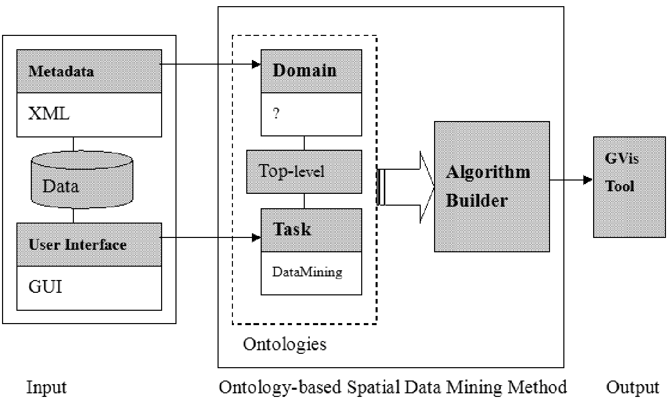
The core innovation is the Ontology-Based Spatial Data Mining (OBSC) framework. It replaces manual tuning with a three-pillar system:
1. Domain Ontologies (The "What" and "Where")
These define the semantics of the data. For traffic accidents, the domain ontology specifies that an Accident is a subclass of Temporal-Thing and has a spatial constraint: it must occur on a Road.
2. Task Ontologies (The "Why")
These capture the user's goal. If the goal is "Find Hot Spots," the task ontology selects a hierarchical method. If the goal is "Assign Markets," it might choose a partitioning method.
3. The Algorithm Builder
This is the "engine room" where the magic happens. It takes the constraints from the Domain Ontology and the requirements from the Task Ontology to construct an algorithm instance that is semantically informed.
Experimental Validation: Avoiding the "Harbor Trap"
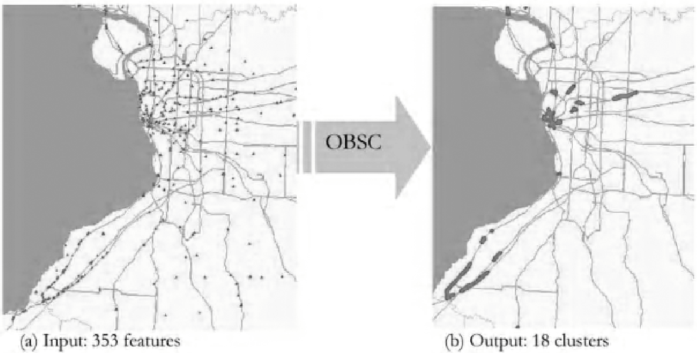
The researcher tested the framework on 7,413 geocoded fatal accident cases in New York State.
The Effect of Physical Constraints
In a classic "Control" algorithm, a cluster was formed spanning across the New York Harbor, effectively suggesting accidents happen on the water.
- OBSC Result: By consulting the Domain Ontology, the algorithm "realized" that accidents cannot occur in the water. It successfully split the cluster into Manhattan and Brooklyn components.
The Effect of Scale
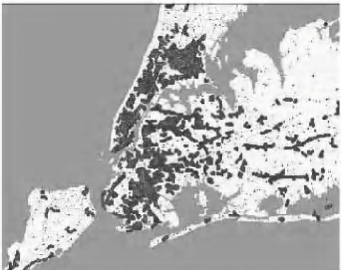
When users focused on Manhattan, the Task Ontology automatically adjusted the "cut-off" values in the hierarchical clustering to provide finer detail, whereas the control algorithm produced large, useless blobs.
Critical Insight & Conclusion
The true value of this paper lies in Semantic Reusability. It argues that we don't always need better "math"; we need better "context." By formalizing what we know about the world (Ontology), we can make existing algorithms work much harder.
Takeaways for the Industry:
- For GIS Developers: Integration of metadata and ontology can automate the "black box" of parameter selection.
- For Researchers: This work paves the way for "Inductive-Ductive" hybrid systems, where machine learning (induction) and formal logic (deduction) enrich each other.
Limitations: The paper relies on the existence of well-defined ontologies. In domains where formal schemas are missing, the "Algorithm Builder" cannot function. Future work should look into automatically inducing these ontologies from raw data.