
Tracking the Deluge: How AI Transforms Social Media into a Passive Hotline for Flood Management
SPECIAL SECTION ON FUTURE GENERATION SMART CITIES RESEARCH: SERVICES, APPLICATIONS, CASE STUDIES AND POLICYMAKING CONSIDERATIONS FOR WELL-BEING [PART II]
The paper introduces an AI-enabled framework for real-time flood monitoring by extracting spatial and temporal information from social media (Twitter). It employs a dual-stream approach: Computer Vision (ResNet) to classify images into four disaster management phases (preparedness, impact, response, recovery) and Deep Learning NLP (NeuroNER) to geoparse street-level locations from text.
TL;DR
Disaster management is often a race against time where information is the most valuable currency. This paper presents an AI-driven framework that mines Twitter data to track the four phases of flooding (Preparedness, Impact, Response, Recovery). By combining Computer Vision (ResNet) for image classification and Deep Learning NLP for street-level geoparsing, the researchers established a "Passive Hotline" that captures critical onsite incidents—like trapped residents or road damage—providing a high-resolution "orthogonal" view that traditional sensors and official media often miss.
The Motivation: Why Sensors Aren't Enough
Urban flooding is a dynamic, high-stakes threat. While satellite imagery and sensor networks are standard, they fail during heavy cloud cover or in areas where infrastructure is sparse. Furthermore, government reports are often delayed. Social media offers a "human sensor network," but the sheer volume of data is overwhelming and noisy. The authors identified a gap: most prior work only looked at "if" it was flooding (binary classification). They realized that identifying when the phase changes (e.g., from preparedness to impact) and exactly where on a street level an incident occurs could save lives.
Methodology: The Two-Stream AI Pipeline
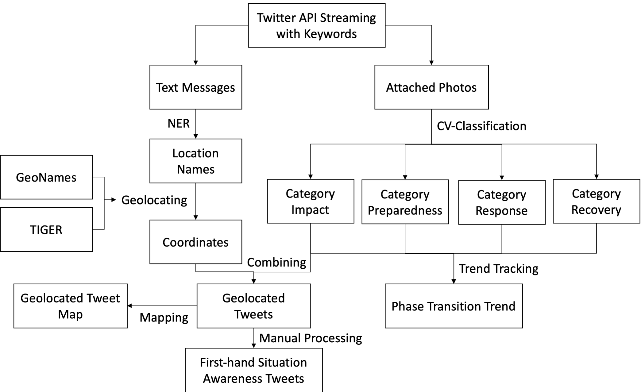
The framework processes two distinct data streams to ensure a comprehensive situational picture.
1. Visual Phase Tracking (Computer Vision)
Instead of a simple "flood/no-flood" filter, the authors trained a ResNet architecture to categorize images into four disaster management phases. This allows emergency managers to see the "phase transition" in real-time.
- Impact: Onsite witness evidence (the most critical for rescue).
- Preparedness: Forecasts and warnings.
- Response: Rescue activities and media reports.
- Recovery: Cleaning and rebuilding.
2. Street-Level Geoparsing (NLP)
Since Twitter removed precise geotagging, the researchers used NeuroNER (an LSTM-based model) to recognize place names in text. To solve the problem of missing road data in global gazetteers like GeoNames, they rapidly compiled a local gazetteer using US Census TIGER data, allowing them to resolve toponyms down to the center of specific road segments.
Results: Hurricane Harvey Case Study
The system was stress-tested using 7 million tweets from Hurricane Harvey.
- Accuracy & Reliability: The ResNet model achieved an 0.88 F1-score for the "Impact" category.
- Temporal Insight: The AI successfully captured the shift in public discourse. The "Preparedness" category peaked two days before the "Impact" category, while "Recovery" lagged by two days, providing a clear temporal map of the disaster's evolution.
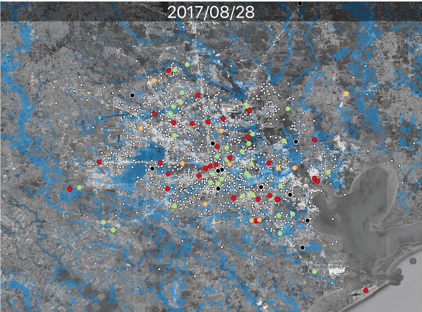
- The "Passive Hotline": By filtering for high-confidence "Impact" images associated with street names, the team identified 13 high-priority rescue leads that provided "orthogonal" information—details like crocodiles in streets or specific nursing home flooding—that were not prioritized by mainstream media.
Critical Analysis: Is This the Future?
The paper highlights a significant shift: social media is moving from a "supplementary" tool to a "foundational" one for situational awareness.
Strengths:
- Shift from Binary to Phase-based: Tracking the transition between phases is far more useful for resource allocation than just detecting a flood.
- Granularity: Integrating TIGER road data solves the "last-mile" problem of geoparsing.
Limitations:
- Data Representativeness: Social media users are a subset of the population; it does not represent the whole field.
- The Geotagging Hurdle: As platforms increase privacy, "tweet-about" location extraction becomes harder, relying heavily on the quality of local gazetteers.
Conclusion
This research proves that AI can turn the chaotic noise of social media into a structured, actionable stream of intelligence. By establishing a Passive Hotline, emergency responders can gain visual evidence of street-level incidents in real-time. The next frontier will likely involve Multimodal Data Fusion, blending this "human sensing" with physical hydrodynamic models to create a truly resilient urban monitoring system.