
Graph Optimization: Scalable Indoor Mapping via Crowdsourced Activity Landmarks
A Graph Optimization-Based Indoor Map Construction Method via Crowdsourcing
The paper introduces a graph optimization-based indoor map construction method using smartphone-based crowdsourcing. By detecting activity landmarks (e.g., turns, elevators) and utilizing Pose Graph Optimization (PGO), the system aligns disparate user trajectories into a coherent indoor map without prior blueprints.
TL;DR
Building indoor maps usually requires either expensive laser scanners or private building blueprints. This paper presents a breakthrough method that uses the sensors already in your pocket. By treating human activities (like taking an elevator or turning a corner) as "landmarks" and applying Pose Graph Optimization (PGO), the authors can fuse noisy, uncalibrated smartphone trajectories into a precise 2D map with an 80th percentile error as low as 1.7m.
The Challenge: Blind Initialization and Noisy Crowdsourcing
Indoor mapping via crowdsourcing faces three major hurdles:
- Blind Initialization: Unlike outdoor GPS, indoor trajectories start at arbitrary coordinates with unknown headings.
- Sensor Drift: Pedestrian Dead Reckoning (PDR) accumulates error over time, causing trajectories to "warp."
- Map Geometry: Many prior works assume buildings are made only of right angles, failing completely when faced with modern curved architecture.
Methodology: The SLAM-Inspired Pipeline
The authors treat the indoor environment as a Link-Node Model. The core "magic" happens through a two-stage optimization process that mirrors the back-end of robotic SLAM (Simultaneous Localization and Mapping).
1. Activity Landmark Detection (LPP)
The system identifies Loop Position Poses (LPP)—specific points where users perform activities like:
- Turning (detected via Gyroscope)
- Taking Elevators/Escalators (detected via Barometer and Accelerometer)
- Walking Stairs
2. Trajectory Alignment and Pose Graph Optimization
Once LPPs are identified and clustered using WiFi fingerprints, the system builds a graph.
- Nodes: Represent the relative transformation matrices for each trajectory.
- Edges: Represent the constraints (shared LPPs) between different users' paths.
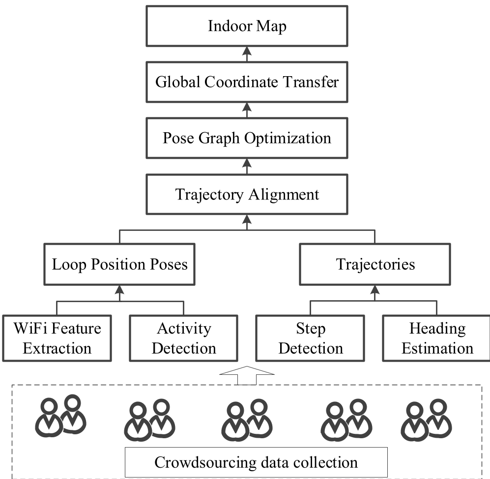 Figure 1: The proposed system flow, from raw sensor data to a refined global map.
The optimization is solved using the Levenberg-Marquardt (LM) algorithm, which minimizes the distance between predicted and observed landmarks across all user trajectories.
Visualizing the Transformation
The strength of the graph-optimization approach is most evident when comparing raw data to the final output. The "noisy" overlaps are resolved into clean pathways that reflect the actual floor plan.
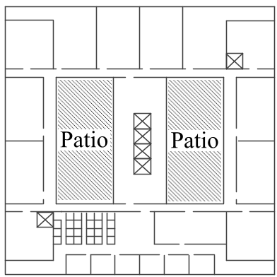 Figure 2: Evolution of the map: (a) Raw noisy trajectories vs (d) the final global map alignment.
Experimental Performance
The researchers tested the system in an academic building and a large shopping mall (Coastal City, Shenzhen).
- Accuracy: The 80% error threshold was 1.9m in the office and 3.5m in the more complex shopping mall environment.
- Efficiency: Compared to the previous state-of-the-art (ALIMC), this method requires significantly less data. It achieved high accuracy with just 15 minutes of walking data, whereas older methods needed up to 150 minutes to converge.
- Curved Routes: Unlike MDS-based methods, this graph-based approach successfully mapped curved corridors by treats "intermediate poses" as optimizable variables rather than just straight links between nodes.
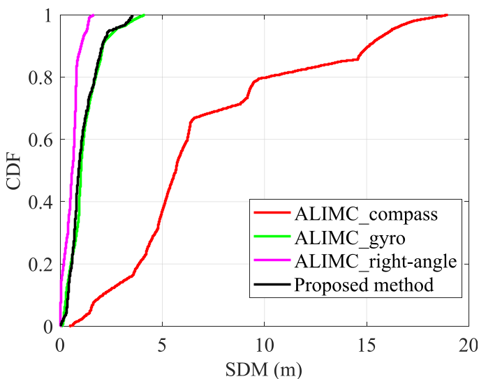 Figure 3: Cumulative Distribution Function (CDF) showing the proposed method outperforming existing benchmarks (ALIMC).
Critical Insight: Why Does This Matter?
The real value of this work lies in its data efficiency. Most crowdsourcing projects fail because they require a "critical mass" of data that is hard to collect. By using a more sophisticated mathematical back-end (Levenberg-Marquardt and PGO), this method lowers the barrier to entry for indoor mapping, making it possible to map a new building in a fraction of the time.
Conclusion and Future Outlook
The study successfully bridges the gap between high-end robotics (SLAM) and consumer-grade mobile sensing. While there are still limitations—such as the need for a few "reference points" to align to absolute coordinates—the ability to generate curved indoor maps from just 15 minutes of random walking is a significant step toward autonomous, self-updating indoor navigation systems.