
Beyond Connectivity: Bridging Population Flow and Public Services in Urban Community Detection
Toward Identifying the Urban Community Structure from Population Flow and Public Services Distribution
The paper introduces a unified framework for identifying urban community structures by integrating population flow (Interaction Between Geographical Zones, IGZ) and public services coverage (Distribution of Public Services, DPS). It models regional delineation as a constrained graph modularity optimization problem, achieving superior community detection accuracy on real-world datasets from Nanjing.
TL;DR
Researchers from Southeast University have developed a new framework to identify urban communities by looking at both how people move and where services are located. By augmenting traditional graph modularity with a "Distribution of Public Services" (DPS) constraint, their model avoids common pitfalls like isolated urban pockets and fragmented districts, mirroring actual governmental city plans with high precision.
Context: Why "Density" Isn't Enough
In the realm of Smart Cities, a "community" is more than just a cluster of people; it is a functional unit where residents can live, work, and access essential services. Most existing community detection algorithms (like Louvain or Spectral Clustering) focus purely on Interaction Between Geographical Zones (IGZ)—essentially, where the phone pings and traffic flows.
However, this leads to two critical failures in urban planning:
- Isolated Nodes: Strategic areas that might have lower traffic but are vital for service distribution are often left "homeless" by greedy algorithms.
- Geographical Fragmentation: Algorithms that ignore physical proximity may group distant zones together just because of digital interactions, creating non-contiguous "communities" that are impossible to govern.
Methodology: The IGZ-DPS Framework
The authors formulate the problem as a single-objective optimization:
- (Modularity): Measures the strength of population flow within communities compared to a random distribution.
- (Public Service Satisfaction): A new metric based on a function , which checks if a community meets minimum thresholds () for various service categories (e.g., hospitals, schools, parks).
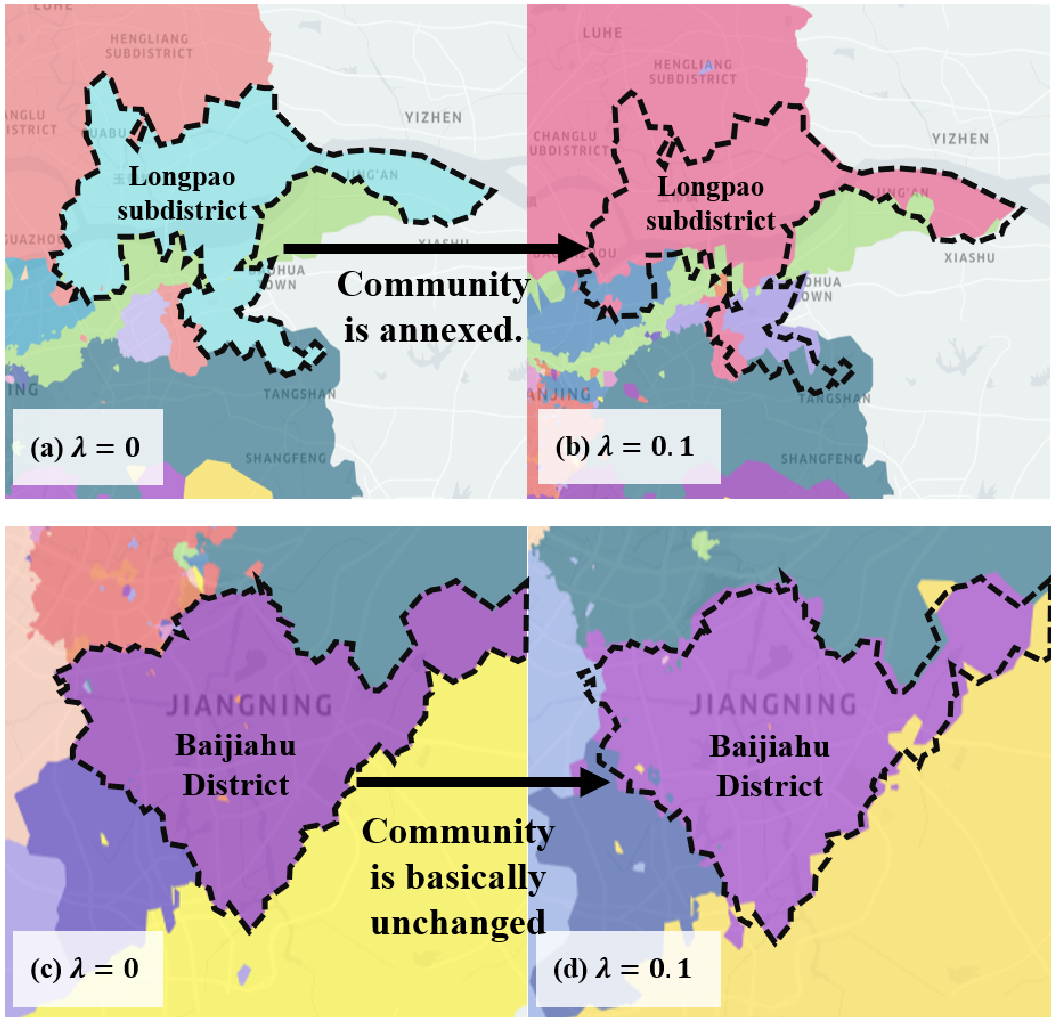
- : A hyperparameter that allows planners to tune how much weight is given to service "equality" versus movement density.
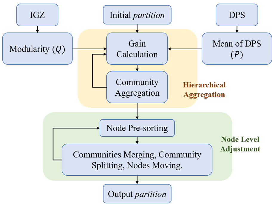
The Two-Stage Algorithm
To solve this NP-hard problem efficiently, the team proposed a hybrid approach:
- Hierarchical Aggregation: Similar to the Louvain method, it merges nodes to capture the primary structure.
- Node Level Adjustment (with Pre-sorting): They refined the "Combo" algorithm by adding a connectivity-based pre-sorting mechanism. This prevents the "random walk" inefficiency and ensures that nodes are moved to target communities where they actually belong, effectively fixing the "isolated node" problem.
Experiments: Real-world Validation in Nanjing
The model was tested using a massive dataset from Nanjing, China:
- 11,813 Geographical blocks.
- 379,928 Points of Interest (POIs).
- 135 million Call Detail Records (CDRs) per day.
Performance Highlights
The proposed method outperformed classic baselines like Label Propagation (LPA) and Spectral Clustering (SCA) across both synthetic and real datasets. Specifically, it achieved a higher Normalized Mutual Information (NMI) of 0.798, indicating a much tighter fit to the ground-truth functional structure.
 Legend: The gray dots in (a) and (c) represent isolated nodes—a failure of prior methods—which are successfully integrated into functional communities in the authors' model (d).
Case Study: Aligning with the Government
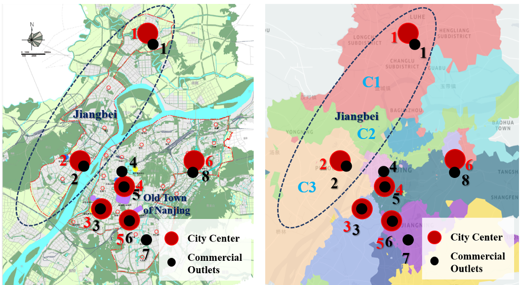
When compared against the official Nanjing City Master Plan (2011-2030), the algorithm's output (as seen in the image below) showed remarkable consistency. It correctly identified the emerging business centers in the Jiangbei District and split communities based on the actual diversion of resident behavior between competing commercial outlets.
Critical Insight & Future Outlook
The brilliance of this work lies in its Inductive Bias. By forcing the algorithm to care about service thresholds, the researchers effectively "regularized" the graph partitioning process to respect urban logic.
Limitations: Currently, all POIs of a certain type are treated equally. In reality, a massive general hospital has a different impact than a small clinic. Next Steps: Future iterations could incorporate "service quality" and "accessibility" (travel time) rather than just raw counts, further refining the "15-minute neighborhood" vision.
Conclusion
This paper provides a robust mathematical foundation for what urban planners have known intuitively: a community is defined by where you go and what you can find when you get there. By merging CDR data with POI distributions, we move one step closer to truly automated, intelligent urban design.