
IndoorWaze: Rewriting the Map of Indoor Navigation via Collaborative Crowdsourcing
IndoorWaze: A Crowdsourcing-Based Context-Aware Indoor Navigation System
IndoorWaze is a crowdsourcing-based indoor navigation system that automatically generates context-aware floor plans with labeled points of interest (POIs). It fuses Wi-Fi fingerprints from both shoppers and store employees with smartphone IMU data to achieve high-fidelity mapping and room-level localization.
TL;DR
IndoorWaze is a breakthrough system that solves the "last mile" of indoor navigation: the lack of labeled floor plans. By combining passive sensor data from shoppers with deliberate, minimal "anchor" data from store employees, it automatically builds high-fidelity maps that know exactly where stores are, how big they are, and how to navigate between them using intuitive, context-aware audio commands.
The "Labeled Map" Motivation
We have all been there: standing in a massive, multi-story shopping mall, staring at a static "You Are Here" kiosk, trying to figure out which way to turn for the Nike store. While GPS solved outdoor navigation decades ago, indoor spaces remain a "black box."
The core problem isn't just localization (knowing your coordinates); it's context. Modern localization methods are accurate, but they are useless without a labeled map. Manually surveyings thousands of malls is a logistical nightmare. IndoorWaze asks: What if the people living and working in these spaces built the map for us?
Methodology: The Fusion of High-Fidelity Data
IndoorWaze operates on a clever realization: store employees are stationary "anchors" who want to be found, while shoppers are mobile "probes" who map the pathways.
1. The Strategy of Dual-Crowdsourcing
- Store Employees: Perform a one-time "check-in" by recording Wi-Fi RSSI (Received Signal Strength Indicator) for 20 seconds at store entrances. This creates a labeled "fingerprint."
- Shoppers: Simply walk. Their phones record IMU (Inertial Measurement Unit) data—steps, turns, and movements—while scanning for Wi-Fi signals in the background.
2. Iterative Floor-Plan Construction
The system uses an Iterative Displacement Algorithm (Algorithm 1) to stitch these traces together. It treats stores as vertices in a graph and displacements (steps/turns) as edges. Because raw IMU data is noisy, the system iteratively adjusts the coordinates of each "store vertex" until the global error is minimized.
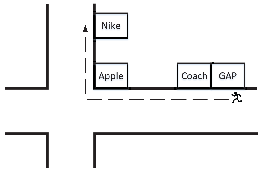 Fig 1. The IndoorWaze Architecture: From raw sensor data to a navigable, labeled map.
3. Conquering Signal Fluctuation
Wi-Fi signals are notoriously "jittery" (multipath fading, human interference). IndoorWaze uses Gaussian Distribution Modeling for each Access Point (AP). Instead of looking for an exact match, it calculates the Maximum Likelihood that a shopper’s current signal matches a store employee’s recorded fingerprint.
Experimental Validation: Real-World Performance
The authors tested the system in a massive 120,000 m² mall. Focusing on a 25-store sector, the results were impressive:
- Labeling Accuracy: 100% of the stores were correctly identified and placed in the correct sequence.
- Shape Reconstruction: The system correctly identified pathways and crossings, even differentiating between stores on opposite sides of a hallway.
- Dimension Precision: The median error in estimating how wide a store is was only 2.5 steps (approx. 12%).
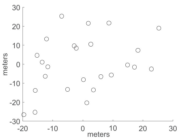 Fig 2. Evolution of the map: From a rough graph (5 iterations) to a high-fidelity floor plan (20 iterations) that matches the ground truth.
Why This Matters: Beyond the Mall
The primary value of IndoorWaze lies in its scalability. Because it requires no specialized hardware and minimal manual effort (no taking photos or manual check-ins for shoppers), it can be deployed rapidly.
Key Insights:
- Contextual Instructions: Instead of "Turn 90 degrees North," IndoorWaze enables "Turn right at the Apple Store." This is a game-changer for accessibility, particularly for visually impaired users.
- Implicit Mapping: It proves that the "Waze model"—using passive user movement to update a central map—is viable indoors if provided with just a few semantic anchors.
Critical Insight & Limitations
While highly effective, IndoorWaze assumes a degree of cooperation from store employees. The "incentive problem" is real: why would a busy employee take 5 minutes to map their entrance? The authors suggest that being discoverable to shoppers is the primary motivator, similar to how business owners manage their Google Maps profiles. Furthermore, the system currently struggles with multi-story handling and dynamic floor plan changes (e.g., a store closing), which are areas for future research.
Conclusion
IndoorWaze provides the "missing link" for indoor LBS (Location Based Services). By turning every smartphone into a mapping tool and every store employee into a local surveyor, it creates a living, breathing digital twin of the complex indoor world.