
Safeguarding the Past via the Cloud: A Machine Learning Approach to Heritage Risk
Integrated Methods for Cultural Heritage Risk Assessment: Google Earth Engine, Spatial Analysis, Machine Learning
The paper proposes an integrated methodology for Cultural Heritage (CH) risk assessment using Google Earth Engine (GEE), Machine Learning (Random Forest), and Spatial Analysis. It successfully maps vulnerabilities and multi-hazard layers (urban growth, landslides, floods, and erosion) for the rural territory of Matera, Italy.
TL;DR
Researchers have developed a comprehensive framework to protect "forgotten" rural cultural heritage. By integrating Google Earth Engine (GEE), Random Forest classification, and GIS spatial analysis, the study maps risks ranging from urban sprawl to soil erosion in Matera, Italy, providing a reproducible protocol for global conservation.
Problem & Motivation: The Vulnerability of Rural Landscapes
While cultural heritage (CH) within consolidated city centers often enjoys robust legal and physical protection, heritage elements scattered throughout rural landscapes—such as ancient rock-cut settlements or dry stone walls—remain highly vulnerable. These sites face a dual threat: natural hazards (landslides, floods, and erosion) and anthropic pressure (uncontrolled urban growth).
The primary challenge in monitoring these risks is the sheer volume of data. Analyzing thirty years of satellite imagery to detect subtle land-use changes requires immense computational power and high-resolution data that traditional desktop GIS systems often struggle to handle.
Methodology: High-Performance Computing meets Archaeology
The core of this research lies in the synergy between three technological pillars:
- Google Earth Engine (GEE): Used for cloud-based processing of Landsat 5 and 8 imagery. This eliminated the need for massive data downloads and significantly accelerated calculation times.
- Random Forest (Machine Learning): An ensemble learning method used to classify land use. By training the algorithm on specific datasets (urban, water, vegetation), the researchers achieved an accuracy of up to 92%, allowing them to precisely map urban growth from 1990 to 2020.
- Spatial Map Algebra: Using the formula (Risk = Hazard × Vulnerability × Exposure), the team combined individual hazard layers into a final synoptic risk map.
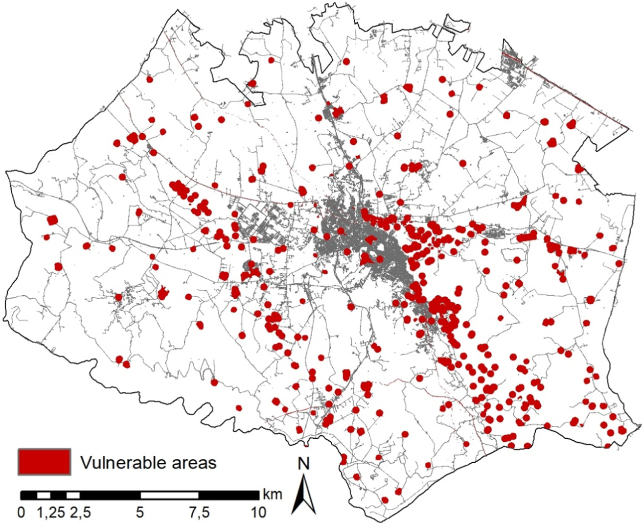 Figure 1: Conceptual visualization of monitoring land use changes via remote sensing.
Experiments & Results: Mapping Matera’s Future
The Matera municipality served as the ideal testbed due to its status as a UNESCO World Heritage site and its complex geological history.
Key Findings:
- Urban Expansion: The urban footprint grew from 9.6 in 1991 to 34.0 in 2020.
- Hazard Distribution: Hazards cover 63.37 of the territory. While floods and landslides are the most prominent (30.7 ), urban growth is a significant secondary threat (25.7 ).
- Direct Impact: Approximately 10% of the vulnerable areas identified around heritage sites are currently threatened by urban encroachment.
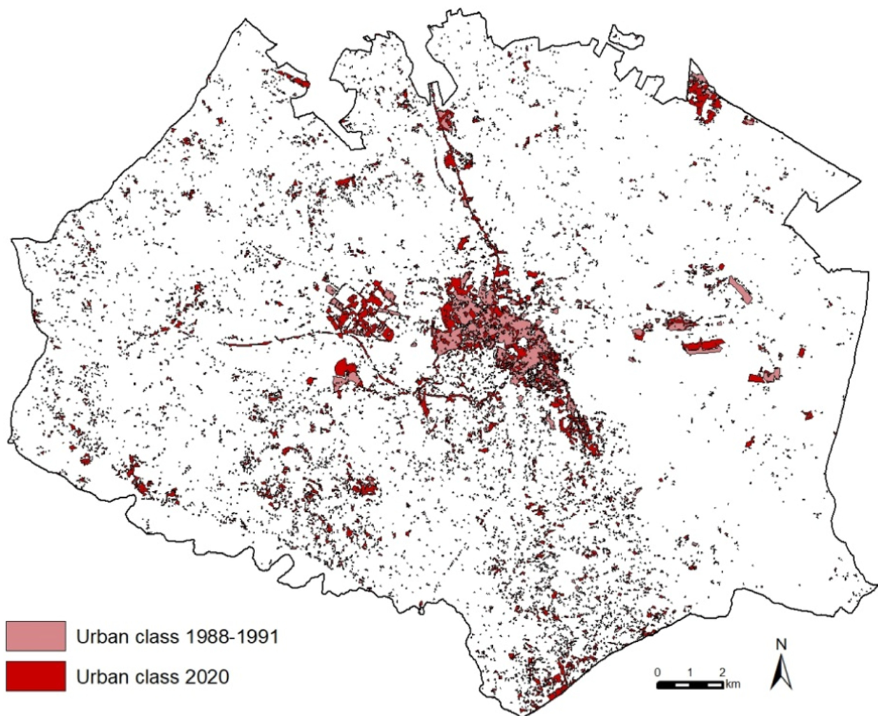 Figure 2: Urban growth extracted with GEE and Random Forest classification for Matera (1990-2020).
The study utilized the USPED model to classify soil erosion, finding that while most areas are stable, specific sectors near the "Gravine" (gorges) face extreme erosion or deposition, which could undermine rock-cut structures.
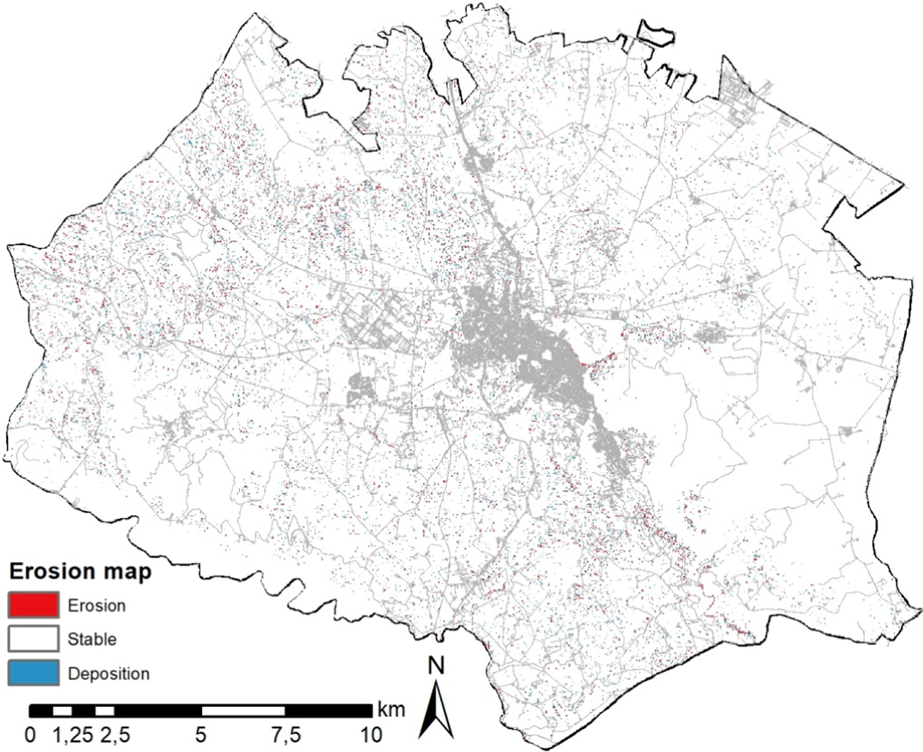 Figure 3: Integrated hazard map showing the spatial distribution of natural and anthropic risks.
Critical Analysis & Conclusion
This work represents a shift toward Preventative Archaeology. By moving from reactive site management to proactive, large-scale risk assessment, heritage managers can prioritize interventions where multiple hazards coexist.
Takeaways for the Industry:
- Automation: The GEE-based protocol can be adapted for any region with minimal local hardware requirements.
- Interdisciplinary Utility: The method bridges the gap between geological surveying and cultural conservation.
Limitations: The study currently treats all heritage elements as having the same "exposure" value. Future iterations should incorporate the specific state of conservation and the unique structural sensitivity of individual artifacts to provide a more nuanced risk score.
Ultimately, this methodology provides a digital shield, ensuring that as our cities grow, our history does not vanish in their shadow.