
Mapping the Green: Robust Red Clover Estimation with Limited Supervision
An Integrated System for Mapping Red Clover Ground Cover Using Unmanned Aerial Vehicles: A Case Study in Precision Agriculture
The paper presents an integrated system for mapping Red Clover Ground Cover (RCGC) using UAV-acquired RGB imagery. By employing a patch-based classification approach and evaluating several machine learning models, the authors achieve a 91% classification accuracy in distinguishing varying clover coverage levels.
TL;DR
Researchers at the University of Guelph have developed an integrated UAV-based system to map Red Clover Ground Cover (RCGC). Facing the classic "small data" problem in agriculture, they proved that a patch-based approach combined with a k-Nearest Neighbor (kNN) classifier can achieve 91% accuracy, even when distinguishing between visually similar species like oilseed radish.
Context: Why Red Clover Matters
In the world of Precision Agriculture (PA), red clover isn't just a plant; it's a vital tool for soil health. As a cover crop, it fixes nitrogen, suppresses weeds, and adds biomass. However, these benefits are only realized if the clover grows uniformly. Traditional ground-level assessment of large fields is impossible, and satellite imagery often lacks the resolution needed for patch-level analysis.
The "Small Data" Challenge
The core friction in applying Machine Learning (ML) to agriculture is the Ground Truth Bottleneck. While we can take thousands of aerial photos, getting a human expert to manually measure and label specific spots in a 30-hectare field is exhausting. Most SOTA methods demand thousands of labels; this study asks: Can we build a reliable map with fewer than 100 samples?
Methodology: The Integrated System
The authors propose a pipeline that bridges the gap between high-altitude UAV flight and ground-level reality.
1. Data Acquisition & Registration
Using a PrecisionHawk Lancaster UAV equipped with a 14MP RGB sensor, the team captured imagery at 100m altitude, yielding a 2.85cm/pixel resolution.
- The Problem: UAV GPS is noisy (±2m error), while ground measurements are precise.
- The Fix: A custom image registration step. They compared histograms of ground photos against potential aerial candidates to find the exact match, ensuring the "Ground Truth" actually aligned with the "Aerial Reality."
2. Patch-Based Visual Reasoning
Instead of classifying every single pixel (which is prone to noise), the system extracts 17x17 pixel patches (representing 0.5m x 0.5m areas). This provides contextual info that a single pixel lacks.
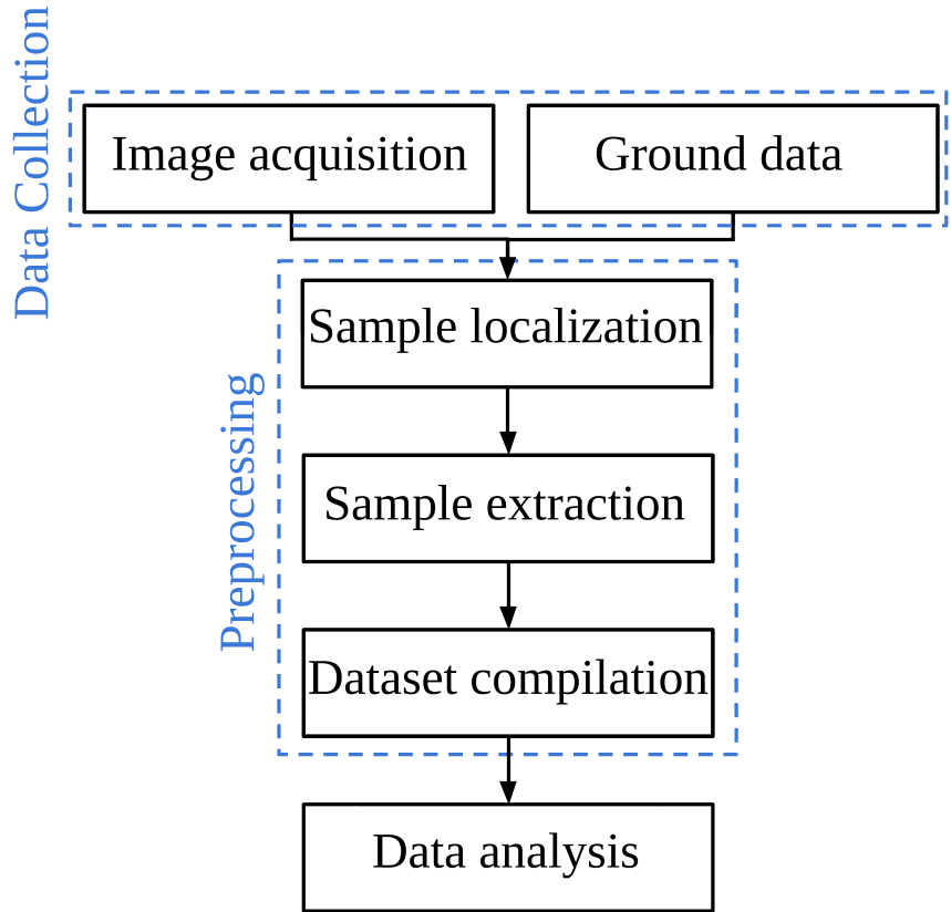 Figure 1: The overarching workflow from flight to classification.
Experiments: Simplicity Wins
The study compared three heavyweights: Neural Networks (MLP), Support Vector Machines (SVM), and k-Nearest Neighbors (kNN).
Feature Engineering
They tested two feature types:
- Raw Pixels: Vectorized RGB values.
- Color Histograms: Frequency of color intensities (tested at various bin sizes).
Results & Insights
Surprisingly, the simplest model—kNN—won.
- Accuracy: 91% using balanced data and histogram features.
- Resilience: While Deep Learning models (MLPs) struggled with overfitting on the 99-sample dataset, kNN remained consistent.
- Species Discrimination: The system successfully distinguished Red Clover from Oilseed Radish, a visual "twin" that often confuses simpler vegetation index-based models.
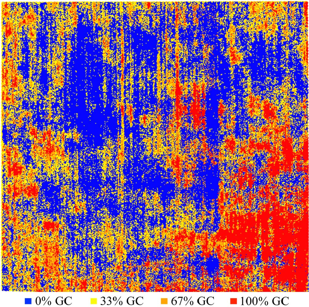 Figure 2: The final RCGC map. Red/Orange indicates high coverage, while Blue indicates bare patches—allowing farmers to precisely target areas for re-seeding.
Critical Analysis & Takeaways
The paper highlights a crucial lesson for Tech Leads in AI: Complexity is not always a virtue.
In environments where data collection is expensive (AgTech, Mining, Underwater Robotics), the Inductive Bias of non-parametric models like kNN provides a protective layer against overfitting. By transforming raw images into color histograms, the authors effectively created a feature space that is invariant to slight shifts in leaf orientation or texture, focusing instead on the "spectral signature" of the clover.
Future Outlook: The next logical step is to move beyond RGB. Incorporating Multi-Spectral data (Near-Infrared) could allow the system to assess not just coverage, but the health and nitrogen content of the clover, providing a 360-degree view of the field's vitality.
Conclusion
This case study proves that with smart preprocessing and a respect for the limitations of small datasets, UAVs can provide actionable intelligence for sustainable farming without requiring "Big Data" budgets.