
Beyond the Coordinates: Fusing Geography and Semantics in LBSN Recommendations
A Recommender System Research Based on Location-Based Social Networks
This paper introduces a Location-Based Social Network (LBSN) recommender system using the Distance-and-Category-based Clustering (DCC) algorithm. By integrating geographic proximity and semantic category similarity from Sina Microblog data, the system mitigates data sparsity and improves location recommendation accuracy through Affinity Propagation clustering.
TL;DR
The explosion of Location-Based Social Networks (LBSNs) has created a data overload problem. This paper presents the DCC (Distance-and-Category-based Clustering) algorithm, which moves beyond simple check-in counts. By combining spherical distance math with a weighted hierarchical category tree, the system clusters locations that are both physically near and semantically related, significantly enhancing the relevance of Online-to-Offline (O2O) recommendations.
The Sparsity Trap: Why Traditional LBSNs Fail
Most modern LBSN recommenders rely on Collaborative Filtering (CF). However, the "Check-in Matrix" is notoriously sparse—most users only visit a tiny fraction of available Point-of-Interests (POIs).
The authors identify a critical gap in prior work:
- Geographic Bias: Some models focus only on physical proximity, ignoring that a "Cinema" and a "University" next door to each other serve entirely different user intents.
- Semantic Ignorance: Other models look at categories but ignore distance, failing to realize that a user interested in "Chinese Food" usually seeks a local option, not one 500 miles away.
The Insight: To truly understand a location's "profile," we must treat it as a leaf node in a semantic tree while simultaneously respecting its coordinates on a spherical Earth.
Methodology: The DCC Strategy
The core of the paper is the transition from the basic Region-density-based Clustering (RC) to the more sophisticated Distance-and-Category-based Clustering (DCC).
1. The Hierarchical Category Tree
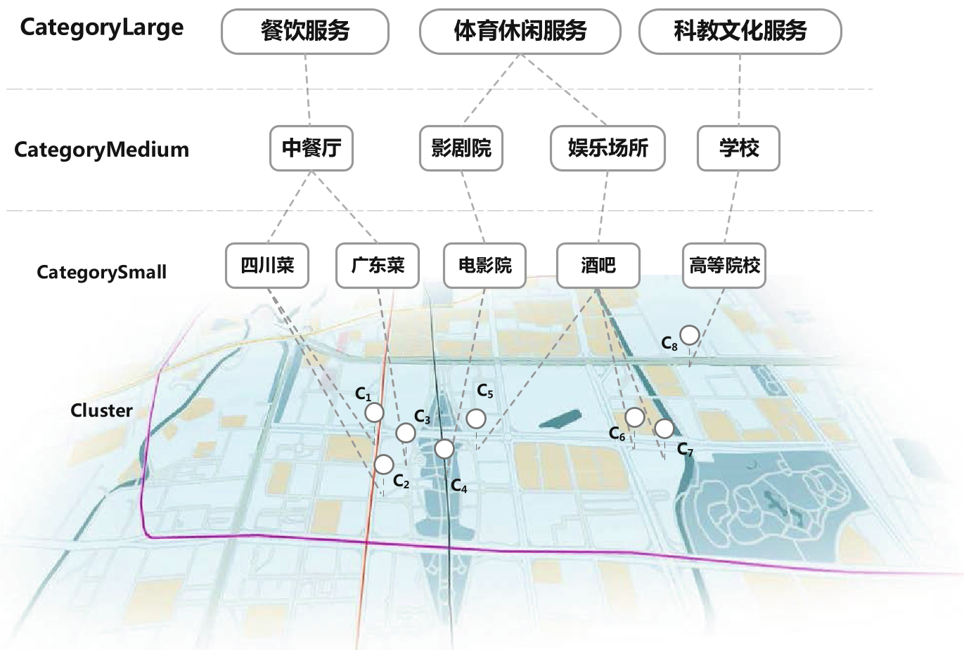
The authors construct a tree where POIs are organized from specific (e.g., Cantonese Restaurant) to broad (e.g., Catering Service). They introduce a dynamic weighting system () for the edges of this tree.
- Low Weights for Popularity: Categories with high check-in volumes are given lower edge weights to facilitate easier clustering.
- Unified Root: By adding a "Root" node, the authors ensure the similarity between any two categories (even seemingly unrelated ones) can be calculated.
2. The Hybrid Similarity Metric
Similarity is calculated as a product of geographic and semantic factors: This formula ensures that for two spots to be clustered, they generally need to satisfy both proximity and functional similarity.
3. Affinity Propagation (AP) Clustering
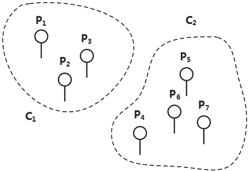
Unlike K-Means (which requires a pre-defined number of clusters) or DBSCAN (which is purely density-driven), the authors use Affinity Propagation. This allows the algorithm to let the data "vote" on its own exemplars, resulting in more flexible, overlapping geographic clusters.
Experiments and Visualization
Using real-world data from Sina Microblog, the authors tested their approach using a standard 80/20 train-test split. The DCC algorithm proved superior in creating clusters that maintain a user's original categorical preferences.
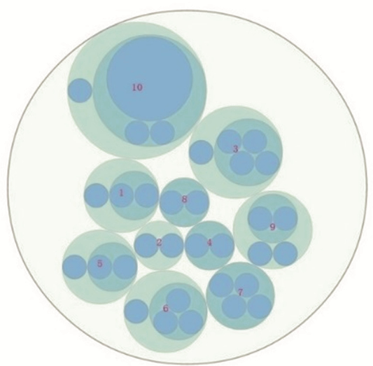
The paper also introduces a Force-Directed Visualization model. This allows users to see the "social distance" and "location relevance" in a graph format, making the "Black Box" of recommendation more transparent.
Critical Analysis & Takeaways
The DCC algorithm is a significant step forward in making LBSN recommendations "smarter" by respecting the context of a location. However, as the authors admit, there are still untapped dimensions:
- Temporal Dynamics: A location's "vibe" changes from day to night (e.g., a cafe that becomes a bar).
- Sentiment Analysis: Integrating user comments could further refine the category similarity (e.g., distinguishing between a "luxury" restaurant and a "budget" one).
Closing Thought: This research underscores that in the world of LBSNs, location is more than just a pair of numbers—it is a node in a complex social and functional web. For developers building O2O platforms, the DCC approach offers a robust blueprint for reducing data sparsity and improving user satisfaction.