
Precision Targeting for Resilient Agriculture: Predicting Maize Yields in Southern Africa
Machine learning model accurately predict maize grain yields in conservation agriculture systems in Southern Africa
This study develops a spatially explicit Random Forest (RF) regression framework to predict maize grain yields across Southern Africa (Malawi, Zambia, Zimbabwe, and Mozambique). By integrating 13 years of multi-location trial data with high-resolution remote sensing variables, the model achieves an accuracy of R² = 0.63 and identifies specific geographic domains where Conservation Agriculture (CA) outperforms conventional practices during climatic extremes.
TL;DR
Researchers have successfully applied Random Forest machine learning to 13 years of trial data across four Southern African nations to map exactly where Conservation Agriculture (CA) works—and where it doesn't. While CA provides a critical safety net during droughts, increasing yields by up to 1 t ha⁻¹, it can actually reduce yields during wet years. This study provides the data-driven "map" needed to target these technologies effectively.
Context: The Spatial Targeting Dilemma
Conservation Agriculture (CA)—defined by minimum soil disturbance, residue retention, and crop rotation—is often hailed as a "climate-smart" solution. However, its adoption in Southern Africa has been sluggish. The reason? It isn't a one-size-fits-all solution. Its success depends heavily on local altitude, soil nutrients, and fluctuating rainfall patterns. Until now, identifying "Recommendation Domains"—the specific areas where CA will actually benefit a farmer—has been based more on intuition than on hard data.
Methodology: Fusing Agronomy with Big Data
The authors leveraged a Random Forest (RF) algorithm, known for its ability to handle "messy" agricultural data characterized by high dimensionality and non-linear relationships.
The Data Stack
The model was built on a robust foundation:
- Agronomic Data: 13 years of on-farm trials from CIMMYT, totaling 1,137 precise GPS locations.
- Remote Sensing: Monthly precipitation (CHIRPS), temperature (TerraClimate), and vegetation indices (MODIS EVI).
- Soil Properties: Physical and chemical characteristics from the SoilGrids250m database.
- Socio-Economics: Cattle density and market access layers.
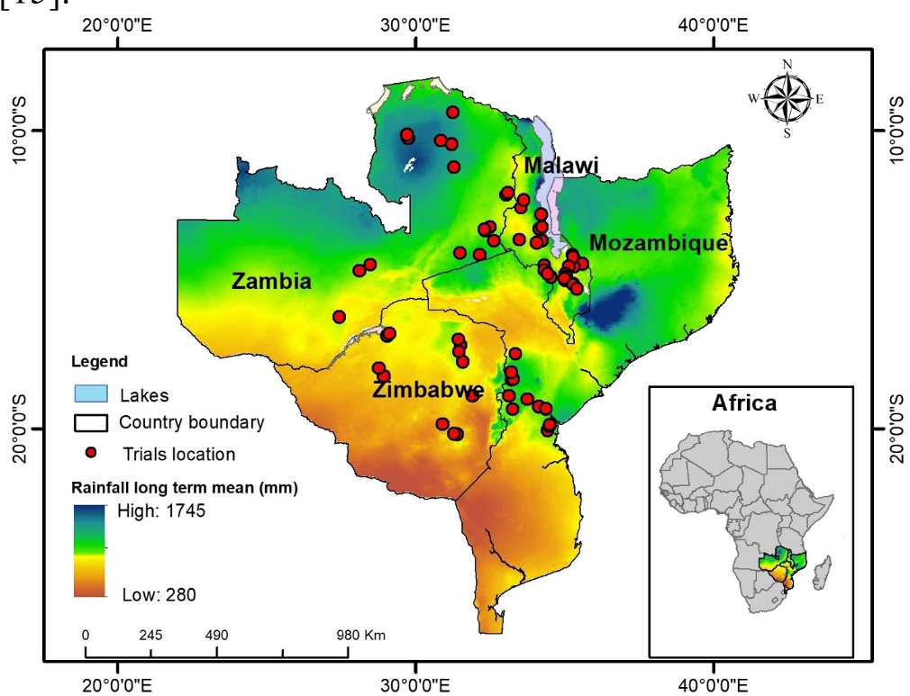 Fig 1: The study area across Malawi, Zambia, Zimbabwe, and Mozambique, superimposed with long-term precipitation data.
The model was parameterized to account for the CA Period (years since implementation), acknowledging that the benefits of soil health improvements often take time to materialize.
Key Insights: Drought Resilience vs. Excess Moisture
The model's performance (R² = 0.63) confirmed that biophysical variables like altitude and February precipitation (coinciding with the critical silking stage) are the strongest predictors of yield.
The "Conservation Paradox"
The most striking finding was the divergence in performance based on rainfall:
- Dry Seasons (e.g., 2004/05): CA systems showed a clear yield advantage of 0.1 to 1.0 t ha⁻¹ over conventional practice (CP) across almost the entire region. This confirms CA’s role in moisture conservation and drought mitigation.
- Wet Seasons (e.g., 2016/17): Conversely, in high-rainfall years, CA often resulted in a yield penalty. This is likely due to waterlogging or nutrient leaching in certain soil types under zero-tillage conditions.
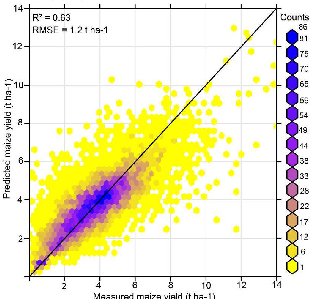 Fig 2: Comparison of predicted yields between dry (a) and wet (b) seasons under conventional practices.
Critical Analysis & Future Outlook
This study marks a shift from "prescriptive" to "precision" agronomy. By acknowledging that CA can sometimes fail (the yield loss in wet years), the authors provide a more honest and useful framework for NGOs and governments.
Takeaway for Practitioners: Don't just promote "Conservation Agriculture"; promote its use in drought-prone zones or on specific soil types identified in these high-resolution maps.
Future Work: While Random Forest is powerful, the transition to Deep Learning (RNNs/Transformers) could further capture the temporal nuances of daily weather events (heat spikes or dry spells) rather than just monthly aggregates. Additionally, future localized models should integrate "Real-time" satellite data to provide in-season advisories to smallholders.
Conclusion
By mapping yield advantages and losses, this research provides a vital decision-support tool. It moves agriculture in Southern Africa away from generalized advice and toward a future where every farmer can know the potential ROI of adopting sustainable technologies based on their specific GPS coordinates and the forecasted climate.