
Beyond the FICO Score: Decoding Microlending through GPS and Social Graphs
Microlending on mobile social credit platforms: an exploratory study using Philippine loan contracts
This exploratory study investigates the efficacy of mobile social credit platforms in the Philippines using a dataset of 784 loan contracts and 3.5 million communication records. The researchers propose a multi-dimensional credit scoring approach integrating baseline financial data, social network graph metrics, and GPS-based geographical landmark proximity to predict loan defaults.
TL;DR
Can your phone’s GPS location and call logs predict whether you'll repay a loan? This study analyzed 784 Philippine loan contracts and 3.5 million communications to find out. The verdict: While your social circle (who you talk to) is a weak predictor, your physical proximity to specific urban landmarks—like city halls versus bus stations—is a goldmine for predicting loan default.
The "Unbanked" Dilemma
In the developing world, traditional credit scores are non-existent for the 250 million people currently served by microlending. Lenders compensate for this "black hole" of information by charging exorbitant interest rates—sometimes up to 80%—just to cover the high cost of default risk assessment. The authors of this study sought to turn mobile data into a "social credit system" that could lower these costs.
Methodology: The Data Triad
The research tested five nested hypotheses by layering three types of information:
- Baseline: Loan amount, interest rate, and duration.
- Social Network: Graph metrics like "Centrality" (how important you are in your network) and "Triads" (friends of friends).
- Location (The Secret Sauce): GPS coordinates of every call/SMS, mapped against 107 Google Maps business types within a 50-meter radius.

Key Insight: "Who You Know" vs. "Where You Go"
In a surprising twist, the researchers found that social network structure was almost useless. Even though initial visualizations showed that "defaulters tend to talk to defaulters" (homophily), the detailed statistical tests suggest this info is mostly noise.
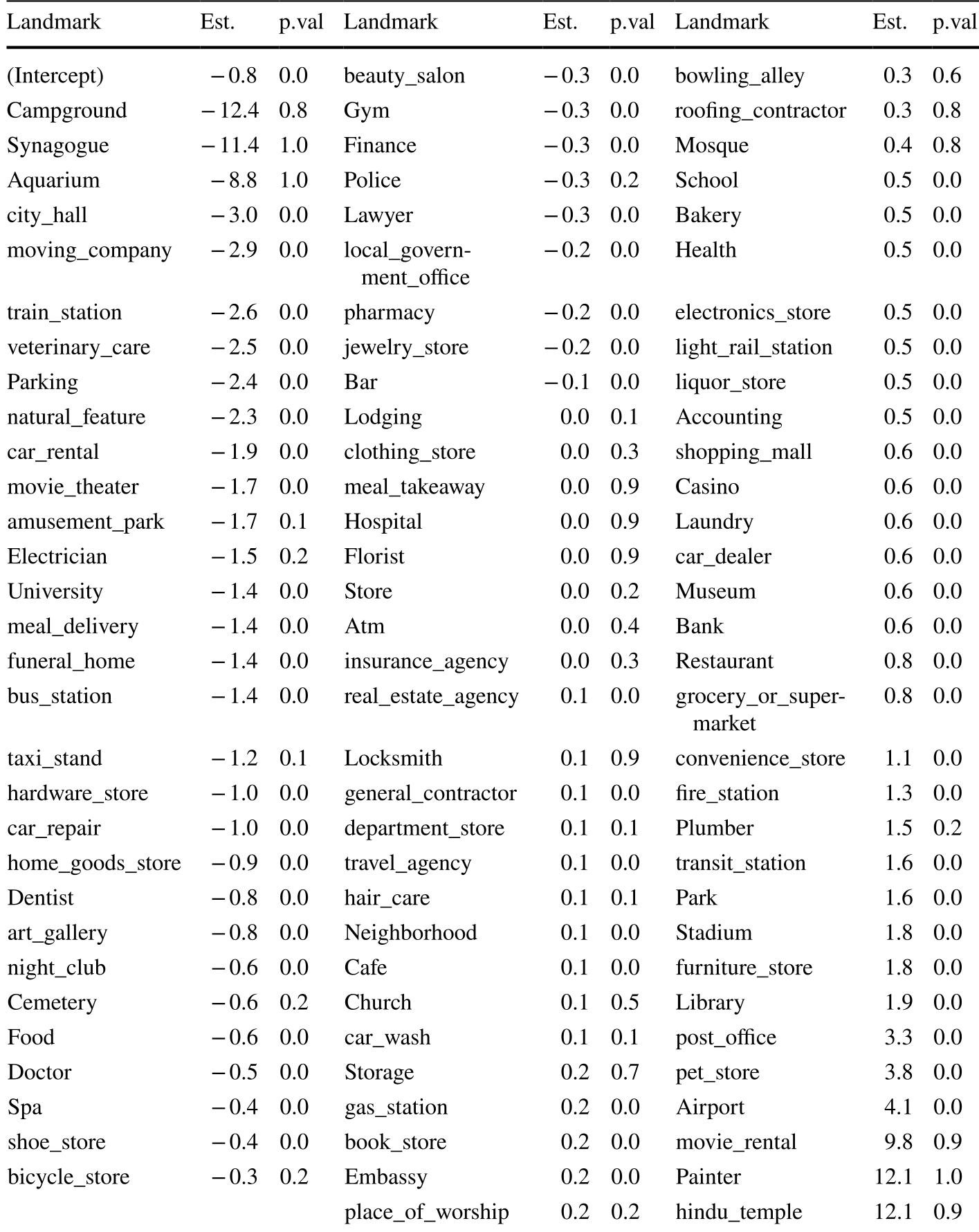
However, Geography proved transformative. The researchers found significant correlations between default rates and proximity to specific landmarks:
- Good Borrowers (Lower Default): Frequently near City Hall, moving companies, train stations, and veterinary care. These are associated with stability, civic engagement, or high-value pet ownership.
- High-Risk Borrowers (Higher Default): Often found near bus stations, parks, stadiums, and furniture stores. These potentially indicate transient lifestyle or high-expenditure leisure.
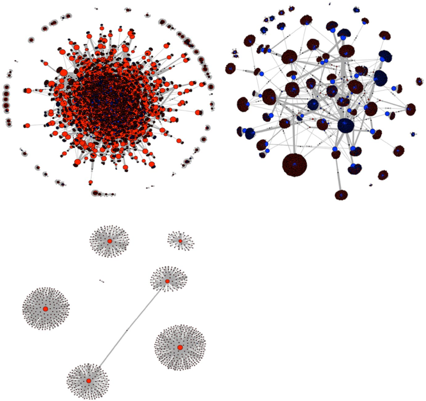 Figure: Force-directed graphs of communications. Blue nodes represent defaults, illustrating the clustering effect (homophily) in the network.
Experimental Results: The Power of Location
The study used the Akaike Information Criterion (AIC) to measure model quality. The lower the AIC, the better the model.
- Baseline Model AIC: ~2.3 Million
- Location-Only Model AIC: ~88,607
- Full Combined Model (H3c) AIC: ~79,416
The massive drop in AIC when location data is added proves that spatial behavior is a vastly superior predictor of financial reliability than traditional loan contract terms alone.
Critical Analysis & Professional Takeaway
This paper provides empirical evidence for the "Social Credit" movement. While Western observers often view such systems through the lens of privacy violations, in emerging markets, they represent financial inclusion.
The Takeaway: If you are building a fintech product for the unbanked, skip the complex social graph analysis. Focus your engineering efforts on geospatial feature engineering. The "physics" of how a person moves through their city tells you more about their economic reliability than their digital "friend list" ever will.
Limitations: The study identifies correlation, not causation. Does being near a bus station cause default, or do people with precarious finances simply use bus stations more? For a lender, however, the "why" matters less than the predictive "is."