
Mining Environmental Data: Data-Driven Intelligence in Hydrological Scenarios
Mining environmental data in hydrological scenarios
This paper introduces data mining methodologies developed within the EU FP7 ADMIRE project for hydro-meteorological forecasting in Slovakia. It focuses on predicting water temperature, discharge wave propagation, and short-term rainfall using Linear Regression and Multilayer Perceptrons (MLP) as alternatives to traditional physical models.
TL;DR
This research presents a transition from rigid physical modeling to flexible data mining for Slovakian flood and water management. Part of the ADMIRE project, the authors demonstrate that by applying rigorous data cleaning and neural network architectures (MLP), they can predict complex variables like water temperature and discharge propagation with over 98% correlation, significantly streamlining the forecast cascade.
Executive Summary
In the realm of environmental management, the "Flood Forecasting Simulation Cascade" has traditionally been the domain of heavy physical simulations. However, the ADMIRE project shifts this paradigm by treating hydrological phenomena as data mining problems. This paper specifically details the ORAVA (reservoir discharge) and RADAR (precipitation) scenarios, proving that machine learning can handle the "messiness" of real-world sensor data while providing high-fidelity predictions.
The Challenge: Dealing with Spatio-Temporal Chaos
Environmental data is notoriously difficult to work with. The authors identify several critical pain points that often cause traditional models to fail:
- Scale Inconsistency: Sensors reporting in Kelvin vs. Celsius.
- Measurement Noise: Database artifacts (e.g., values like -1.0E-20) that skew statistical models.
- Temporal Disparity: Meteorological data might be hourly, while water temperature is measured only once every 24 hours.
To solve this, the authors developed a systematic Data Integration Methodology involving spatial transformation, temporal synchronization, and custom filters like the LinearTrend filter to interpolate missing hourly values based on thermal storage capacity logic.
Methodology: From Raw Sensors to Neural Insights
The core of the ORAVA scenario focuses on predicting the water height (HeightS) and temperature (TempS) below the reservoir.
1. Data Cleaning Pipeline
Before training, the data undergoes a multi-stage refinement:
- ZeroEpsilon Filter: Cleans noise from the database.
- Kelvin2Celsius: Unifies thermal scales.
- Linear Interpolation: Essential for the
Water_Temp_Oravafeature, which is only measured once daily.
2. Model Architecture
The authors compared two distinct approaches:
- Linear Regression: A baseline model providing a transparent, interpretable equation.
- Multilayer Perceptron (MLP): A neural network consisting of five perceptrons using a sigmoid activation for the input layer and linear activation for the output.
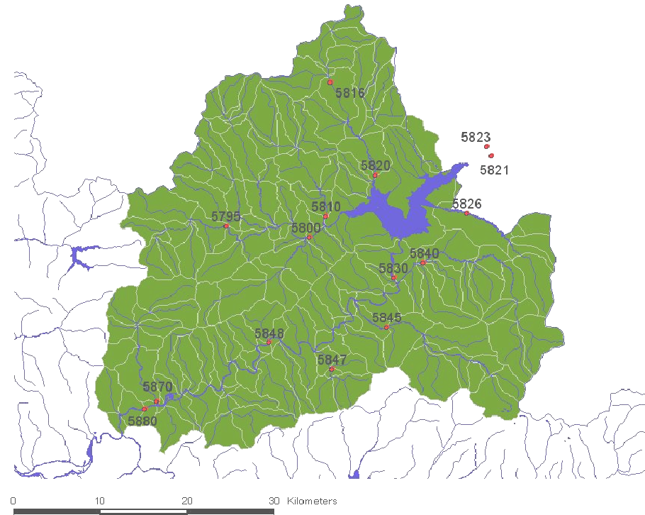 Figure 1: The ORAVA reservoir and the network of downstream hydrological stations.
Performance Analysis: Why Neural Networks Win
The results of the ORAVA scenario clearly demonstrate the superiority of the non-linear approach. While the linear equation is useful for a quick heuristic, the MLP captures the thermal inertia and complex flow dynamics of the river system more accurately.
| Metric | Linear Regression | Multilayer Perceptron |
|---|---|---|
| Correlation Coefficient | 0.9639 | 0.9821 |
| Mean Absolute Error | 1.1791 | 0.7748 |
| Relative Absolute Error | 23.87% | 15.68% |
The MLP model achieved a lower root mean squared error (1.0386), proving that despite the longer training time, the "black box" of neural networks provides the precision needed for critical flood warnings.
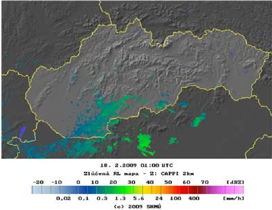 Figure 2: RADAR scenario processing—converting reflectance matrices into precipitation coefficients.
Critical Insight: The "Radar" Frontier
While the ORAVA scenario is a success, the RADAR scenario highlights a significant hurdle in environmental ML: Data Scarcity. The authors attempt to use convolution products of reflectance matrices to predict rainfall. However, they note that finding enough high-quality historical radar images paired with accurate daily rainfall records remains a "hard" problem—a precursor to the modern "Big Data" challenges in climate science.
Conclusions & Future Work
The ADMIRE project proves that data mining isn't just a supplement to physical models; it is a robust alternative. The study concludes that:
- Preprocessing is 90% of the work: Proper synchronization of spatio-temporal data is what makes the model performant.
- Neural Networks provide the edge: MLP architectures are better suited for environmental non-linearity than simple regression.
Future Outlook: As we move toward 2026, the transition from these early MLPs to modern Graph Neural Networks (GNNs) and Transformers for hydrological forecasting seems like the natural evolution of the groundwork laid by the authors in the ADMIRE project.