
Beyond Pixels: Mining GPS Traces and Visual Words for Semantic Event Recognition
Mining GPS traces and visual words for event classification
2008-10-30
Summary
Problem
Method
Results
Takeaways
Abstract
This paper presents a multi-modal framework for classifying semantic events (e.g., hiking, skiing, weddings) in personal photo collections. It utilizes a combination of Frequent Itemset Mining (FIM) to discover compositional visual features and GPS trace analysis, ultimately fusing these cues via multiclass AdaBoost.
## TL;DR
This work shifts the focus of image classification from individual photos to entire collections. By mining "compositional features" (combinations of visual words) and analyzing the literal path a user takes (GPS traces), the authors build a robust system capable of distinguishing complex semantic events like "Hiking" versus "City-tours" that often confuse traditional algorithms.
## The Motivation: Bridging the Semantic Gap
In the era of digital photography, a single image of a "blue sky" is ambiguous—it could be a beach trip, a ski outing, or a backyard BBQ. Prior works often failed because they ignored the **contextual continuity** of a photo album. The authors' intuition is that semantic events are best described by a *composition* of subjects, places, and movements. If we know the user was moving at high speed across a large spatial range, that "blue sky" suddenly looks a lot more like a "Road-trip."
## Methodology: The Power of Composition
The framework relies on three pillars:
### 1. Compositional Visual Features
Instead of simple "Bag-of-Words," the authors use **Frequent Itemset Mining (FIM)** to find groups of visual words that appear together frequently and hold high discriminative power. For instance, "blue sky" + "mountain" = Hiking.
### 2. GPS Trace Analysis
The system treats a collection of photos as a single trajectory. It extracts 22 structural features, including:
* **Spatial**: Range, entropy of distribution, and PCA-based orientation normalization.
* **Temporal**: Entropy of timestamps, median velocity between captures, and total duration.
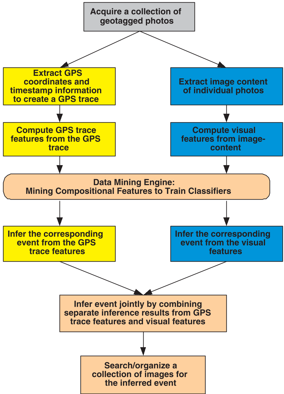
*Figure 1: The system flowchart showing the parallel processing of visual and GPS streams followed by confidence-based fusion.*
## Experimental Insights: When GPS Saves the Day
The team tested their method on 8 event classes. A key finding was the **Synergy of Modalities**:
* **Road-trips**: Visually similar to many outdoor scenes, but GPS traces (high speed, massive spatial range) make them unmistakable.
* **Skiing**: GPS traces vary wildly (small slope vs. large resort), but the visual signature (snow, specific gear) is nearly 100% accurate.
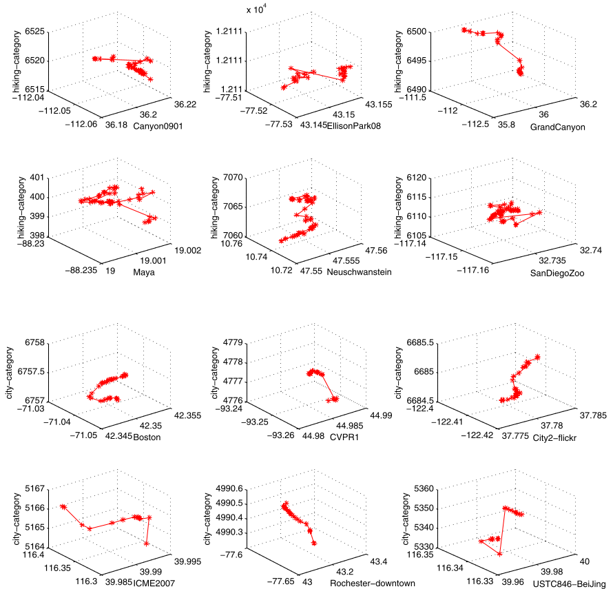
*Figure 2: Distinctive GPS signatures—hiking (top) shows random-walk patterns, while city-tours (bottom) follow piecewise linear street constraints.*
The **Confidence-Based Fusion** (Equation 9) acts as an intelligent referee. By using a confusion matrix to weight the reliability of each modality, the system can ignore a "noisy" visual result if the GPS data is overwhelmingly certain.
## Critical Analysis & Future Outlook
While this 2008-era work uses classic techniques like AdaBoost and SIFT, its core philosophy remains relevant in the age of Foundation Models. The transition from "point-based recognition" to "set-based context" is the direct ancestor of modern video understanding and long-context multimodal LLMs.
**Limitations**: The dataset (88 events) is small by modern standards, and thereliance on GPS precision might struggle in dense "urban canyons."
**Takeaway**: The real value here is the proof that **movement patterns are a semantic language**. For developers building gallery apps or travel diaries, integrating even simple metadata like velocity and spatial entropy can provide a massive lift over raw visual AI.

*Figure 3: A Road-trip event correctly identified by GPS cues despite being misclassified as a "Backyard" by the visual engine.*