
Distributed Gaussian Process: Scaling Collaborative Robot "Vision" Across the Field
Multi-Robot Active Sensing and Environmental Model Learning With Distributed Gaussian Process
This paper presents a distributed multi-robot exploration framework that utilizes Gaussian Process (GP) regression for environmental model learning and active sensing. By employing Karhunen-Loéve (KL) expansion and average consensus protocols, the system enables a team of robots to build a global map and locate environmental peaks in real-time without a centralized server.
TL;DR
Building a shared map of an unknown environment usually requires a "brain" (central server) to process all data. This paper introduces a Distributed Gaussian Process (GP) framework that lets robots build a high-fidelity global map and find environmental peaks using only local communication. By using mathematical "shortcuts" (Karhunen-Loéve expansion) and a consensus protocol, the team achieves global-level mapping accuracy with local-level computational costs.
Context: The Decentralized Dilemma
In environmental sensing—like crop monitoring or terrain surveying—multiple robots are better than one. However, the gold standard for spatial modeling, the Gaussian Process (GP), typically requires a central node to invert massive matrices. As the number of robots (N) and samples (m) grow, the math becomes a bottleneck ().
Existing decentralized solutions often force robots to rely on local estimates, which is like trying to navigate a forest with only a keyhole view: you'll likely miss the highest mountain because it wasn't in your immediate sight.
Methodology: The Math Behind the "Global-to-Local" Bridge
1. Finite-Dimensional Approximation
The core innovation lies in Karhunen-Loéve (KL) Kernel Expansion. Instead of dealing with every single data point relative to every other point, the authors approximate the Gaussian kernel using a set of eigenfunctions. This shifts the complexity from the data size (which grows) to a fixed dimension .
- Physical Intuition: Think of this as performing "Compression at the Source." Instead of sharing raw sensor logs, robots share a condensed mathematical representation of the terrain's shape.
2. Online Information Blending
Robots aren't stationary sensors; they move and collect data continuously. The authors proposed a transition model (Algorithm 1) that allows new measurements to be "naturally blended" into the current estimate through an Average Consensus Protocol.
 Conceptual overview of robots sharing information to reach a consensus on the environmental field.
3. Active Sensing: Exploration vs. Exploitation
Robots decide their next move based on two criteria:
- Exploration: Go where the "Variance" (uncertainty) is high.
- Exploitation: When uncertainty is low, head toward the "Mean" peak. To prevent the robots from huddling together, a Coordination Weight is applied, pushing robots away from each other to cover more ground efficiently.
Experiments & Results
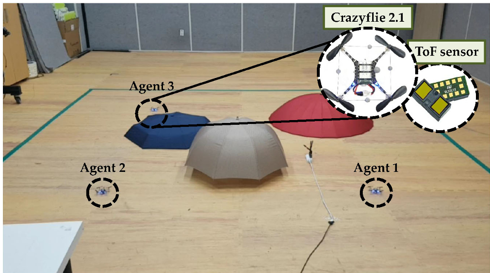
The authors didn't just stay in simulation (). They deployed three Crazyflie nanocopters equipped with laser rangefinders for a topographic survey.
Key Results:
- Convergence: All robots' local maps converged to the true terrain model.
- Efficiency: Robots successfully navigated to the highest peak (39cm beige hill) while maintaining (collision-free distance).
- Scalability: Complexity remains , making it independent of the total number of measurements collected over time.
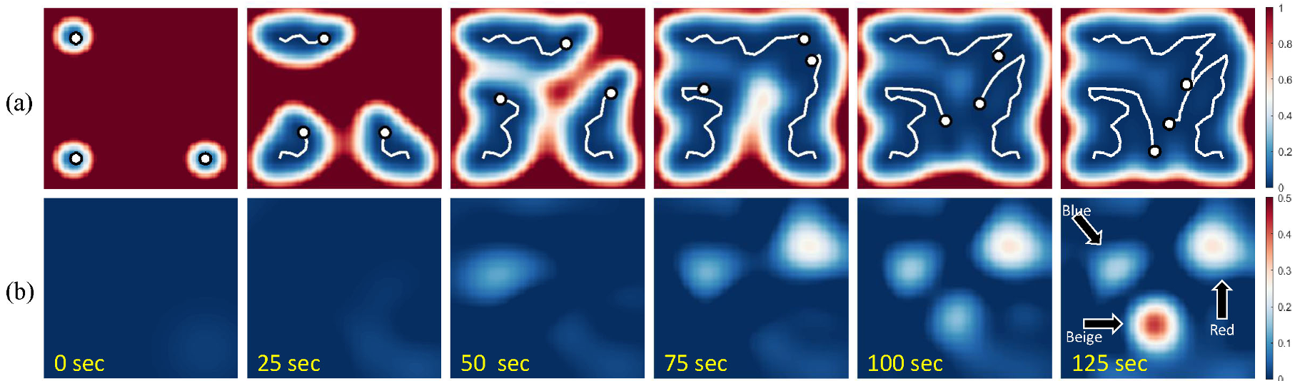 Experimental results showing the uncertainty (variance) decreasing as the UAVs cover the area and refine the mean estimate of the height map.
Critical Analysis & Conclusion
This paper solves a massive headache in robotic sensor networks: how to be "globally smart" while "locally limited." By leveraging the KL expansion, the authors decouple the computational cost from the mission duration.
Limitations:
- The model assumes a stationary environment. If the terrain were changing (e.g., a spreading wildfire), the current consensus protocol might lag behind.
- It requires a connected graph; if a robot drifts too far and loses its neighbors, its global estimate will quickly become outdated.
Takeaway: This is a robust framework for large-scale environmental monitoring. Future work integrating Dynamic Gaussian Processes could allow this system to track moving targets or evolving natural disasters in real-time.