
Urban Micro-Geographies: Decoding Amsterdam’s Pulse via Directed Ensemble Clustering
Network partitioning on time-dependent origin-destination electronic trace data
This paper presents a spatial region identification study using time-dependent Google electronic trace data from the Amsterdam metropolitan area. By applying a directed version of the Louvain community detection algorithm and ensemble learning (consensus clustering), the authors partition the urban space into functional communities based on human mobility patterns.
TL;DR
Researchers leverage Google smartphone trace data to partition the Amsterdam metropolitan area into functional "communities." By evolving the Louvain Algorithm to handle directed flows and utilizing Ensemble Learning to stabilize results, the study uncovers how human movement defines urban boundaries more accurately than traditional administrative maps.
Context: Beyond Administrative Borders
In urban planning, we often rely on "neighborhoods" defined by historical or political lines. However, a city is a living organism defined by flow—where people go, when they leave, and how they congregate. The challenge is that raw mobility data is often "noisy," imbalanced (inflow outflow), and creates nearly fully-connected graphs where traditional clustering algorithms fail to find meaningful separation.
The Core Insight: Directionality and Stability
The authors identified two critical gaps in existing community detection:
- Directionality: A trip from Point A to B is not the same as B to A, especially during morning vs. evening commutes.
- Algorithmic Stochasticity: Greedy algorithms like Louvain are sensitive to the order of node evaluation, leading to different results every time you run them.
Methodology: The Directed Louvain & Ensemble Pipeline
To solve these, the team extended the Modularity metric () to a directed version ():
They then introduced a Consensus Clustering (Ensemble Learning) workflow:
- Step 1: Run the Louvain algorithm 1,000 times with randomized node orders.
- Step 2: Create a Co-association Matrix, where each cell represents the frequency with which two neighborhoods ended up in the same cluster.
- Step 3: Apply hierarchical clustering to this matrix to find the "Core" communities.
 (Note: Refer to Equation 2 and 3 in the text for the modularity formulation)
Experimental Findings
Despite the network being "dense" (almost everyone goes everywhere), the algorithm successfully carved out distinct spatial regions.
1. Spatial Intuition Emerges Mathematically
Even though the algorithm didn't know the longitude/latitude of the neighborhoods, it naturally grouped nodes that were geographically close. The "Zuid-Oost" district, which is physically separated by infrastructure, emerged as a nearly perfect standalone community.
2. Temporal Sensitivity
The study compared weekdays vs. weekends and month-by-month changes.
- The Vondelpark Effect: In August, a specific cluster emerged around a single neighborhood containing a major city park—a clear reflection of summer leisure patterns.
- Post-Tourist Shift: In September, the "City Center" cluster dissolved into the larger "East" cluster, likely indicating the reduction of tourist-centric mobility.
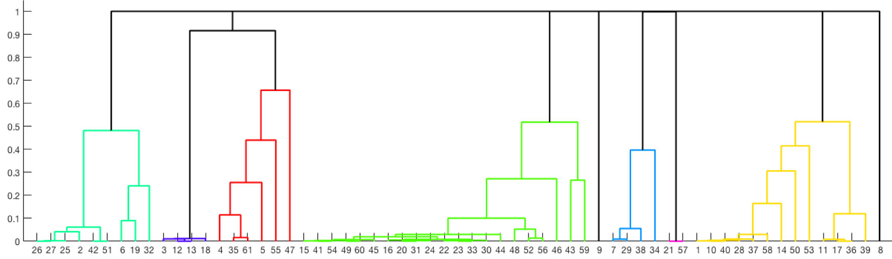 The dendrogram illustrates the dissimilarity between node groups, helping to identify the "heart" of each community.
Critical Analysis & Conclusion
Takeaway
The integration of Ensemble Learning is the true hero of this paper. It transforms a "fragile" greedy heuristic into a robust tool that can withstand the noise of empirical trace data. For city planners, this offers a way to justify public transport expansions based on where people actually move, rather than where they live.
Limitations
A significant limitation is the Modality Agnostic nature of the data. The traces include walking, cycling, and driving aggregated together. A "community" formed by cyclists in the dense Jordaan district might look very different from a community formed by car commuters in the Westpoort industrial zone. Future work must disentangle these "layers" of the city to provide truly actionable insights for specific transport sectors.
Keywords: Community Detection, Louvain Algorithm, Urban Mobility, Ensemble Learning, Origin-Destination Data.