
DigiRo & ARIS: Revolutionizing Archaeological Preservation through Autonomous Robotics
A new approach to digitalization and data management of cultural heritage sites
This paper introduces a comprehensive framework for the autonomous digitization of cultural heritage sites, combining a specialized robotic platform (DigiRo) with a cloud-based Archaeological Information System (ARIS). The system enables high-fidelity 3D reconstruction and semantic mapping in complex, hard-to-access environments like the Priscilla Catacombs.
Executive Summary
TL;DR: Researchers have developed an end-to-end pipeline that replaces dangerous manual human surveys with an autonomous tracked robot (DigiRo) and a cloud-based AI system (ARIS). This system doesn't just "film" a site; it creates semantically aware 3D models of complex underground structures like catacombs, automating the process of decay monitoring and conservation planning.
Positioning: This work represents a major leap from simple robotic exploration to a rigorous Methodological Survey framework, blending real-time SLAM (Simultaneous Localization and Mapping) with advanced computer vision for semantic classification.
Problem & Motivation: The Danger of the Dark
Conserving sites like the Catacombs of Priscilla is a multidisciplinary nightmare. Surveyors face safety risks, and the data is traditionally gathered in fragments—3D scans here, manual notes there.
The authors identify a critical gap: Integration. Even when robots are used, they are usually tele-operated drones that provide a "first look" but lack the systematic coverage required for professional archaeological documentation. The objective here was to build a system that can think for itself, navigate autonomously when connectivity is lost, and organize its findings into a searchable, "intelligent" digital archive.
Methodology: The Core Architecture
The system is split into two halves: the physical hardware (DigiRo) and the digital brain (ARIS).
1. DigiRo: The Autonomous Surveyor
DigiRo is built on a tracked base designed for the uneven floors of catacombs. It features a distributed computing architecture with multiple laptops and single-board computers to handle:
- Real-time SLAM: Using an extension of g2o and Dynamic Covariance Scaling (DCS) to ensure the 3D map stays consistent even when sensor data is noisy.
- Traversability Mapping: The robot converts 3D point clouds into 2D "trafficability" maps, identifying where it can safely travel without getting stuck.
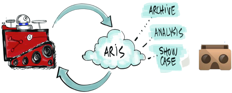 Fig 1: The high-level workflow from robot acquisition to the ARIS information system.
2. ARIS: The Semantic Brain
Once data is uploaded, ARIS performs automated classification. Using a combination of Random Forests and Conditional Random Fields (CRF), it can automatically identify "loculi" (tombs), frescos, and inscriptions. This transforms a raw point cloud into a "Semantic Layer" that can be queried (e.g., "Find all marble epigraphs from the 2nd Century").
Experiments & Results
The system was rigorously tested in the Catacombs of Priscilla (Rome).
- Mapping Performance: The robot generated highly detailed 3D reconstructions (see image below) that are accurate enough for professional archaeological analysis.
- Semantic Accuracy: The machine learning module achieved award-winning results at ICRA 2014, showing that a robot could "understand" the components of an archaeological site with minimal human training data.
- Web Visualization: The ARIS platform handles massive geometric models through a custom streaming WebGL viewer, allowing experts across the globe to collaborate in real-time within the 3D model.
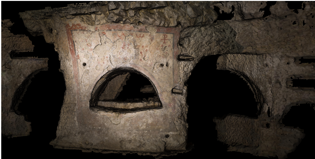 Fig 2: Example of a high-quality image-based reconstruction generated from the robot's camera array.
Critical Analysis & Conclusion
Takeaway
The ROVINA project successfully bridges the gap between "robotics for exploration" and "robotics for heritage science." By automating the data acquisition and semantic labeling, it allows experts to spend less time in hazardous tunnels and more time on high-level analysis.
Limitations & Future Work
- Connectivity: While the robot handles low-connectivity well, full autonomy in extremely labyrinthine environments remains a challenge for real-time data backhaul.
- Complexity of Taxonomies: The automated classification still requires specialized users to define initial taxonomies and provide "seed" annotations.
- Looking Forward: The next frontier is likely the integration of Foundation Models to further automate the semantic understanding of ancient artifacts without site-specific training.
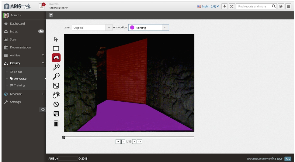 Fig 3: The ARIS point cloud viewer allowing semantic inspection of the digitized site.