
Sensing Haze through the Citizen's Lens: Multimodal Deep Learning for Air Quality Nowcasting
Nowcasting Air Quality by Fusing Insights from Meteorological Data, Satellite Imagery and Social Media Images Using Deep Learning
The paper introduces a multi-modal "nowcasting" framework for air quality (AQI) prediction during haze events in Indonesia. By fusing meteorological data, satellite hotspot imagery, and real-time visibility features extracted from social media photos (Twitter/Instagram) using Deep Learning (CNNs + LSTM), the method achieves a state-of-the-art accuracy of 87.24%.
TL;DR
Researchers from Pulse Lab Jakarta have developed a novel framework that turns social media photos into real-time air quality sensors. By combining deep learning-based image dehazing analysis with traditional satellite and meteorological data, they increased AQI prediction accuracy from 69% to 87%, enabling faster emergency response to Indonesia's trans-boundary haze crisis.
Background & Motivation: The Data Gap in Disaster Management
In Southeast Asia, peatland fires are a recurring catastrophe, driving severe "haze" events that impact health and economies. Current disaster management relies heavily on:
- Ground Sensors: Highly accurate but geographically sparse.
- Satellite Hotspots: Great for locating fires but often delayed or affected by cloud cover.
The authors identified a missed opportunity: Human-Centric Data. Thousands of people post photos of hazy cityscapes on Twitter and Instagram. If an algorithm could "see" the visibility in these photos, it could provide a ground-level, real-time update that satellites cannot.
Methodology: Fusing Physics and Deep Learning
The framework operates as a sophisticated pipeline that translates pixels into pollution levels.
1. The Image Processing Stage
Not every social media photo is useful. To filter the "noise," the authors used:
- VGG-16: To classify and retain only outdoor images, discarding indoor shots or advertisements.
- Dehazing as Measurement: Instead of just cleaning the images, the researchers used AOD-Net and DehazeNet to measure how much "haze" resided in the photo. By comparing the original hazy photo with the algorithmically "cleaned" version using Mean Squared Error (MSE) and Structural Similarity (SSIM), they quantified atmospheric visibility.
2. The Multimodal Architecture
The final prediction isn't based on images alone. The researchers built an LSTM (Long Short-Term Memory) network to handle the time-series nature of the data.
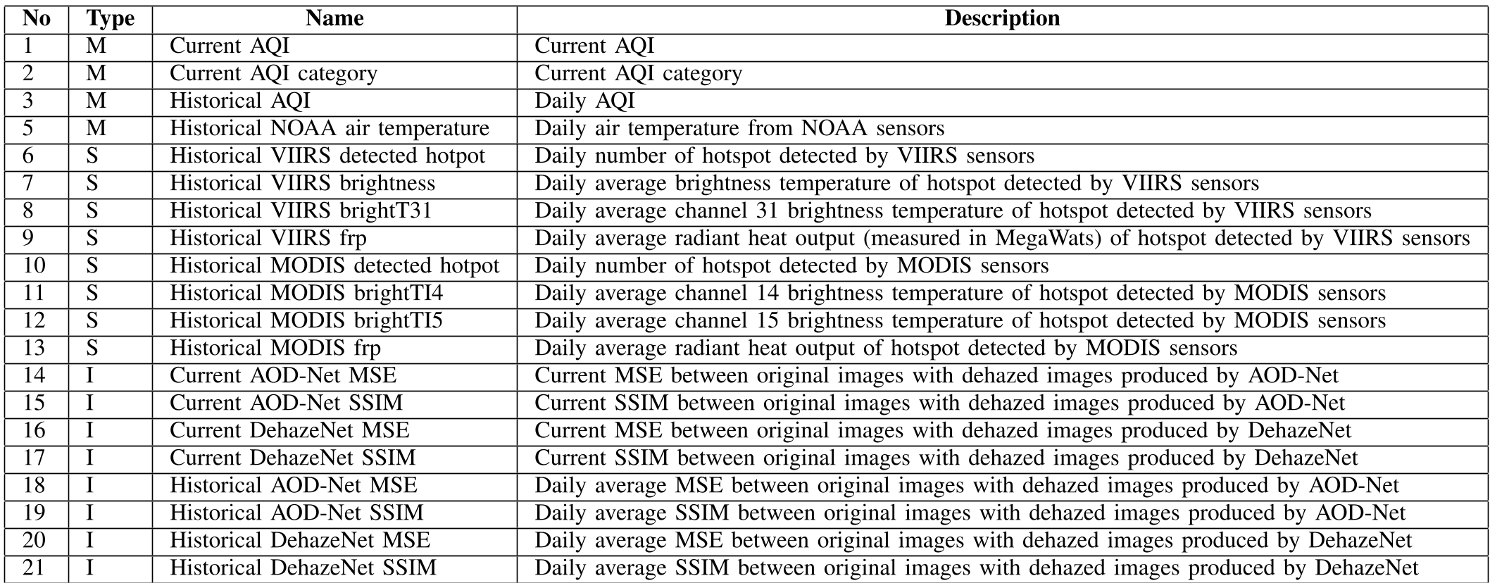
The model fuses:
- Meteorological Data: Temperature and humidity.
- Satellite Data: Hotspot counts and radiant heat (FRP) from MODIS and VIIRS.
- Social Visual Data: Real-time MSE/SSIM scores from crowdsourced photos.
Experimental Results: The Power of Social Sensing
The study focused on Pekanbaru, Indonesia, using a massive dataset of 129,314 social media images.
Key Findings:
- Accuracy Boost: The baseline model (without photos) achieved only 69.13%. Adding social media visual features pushed accuracy to 87.24%.
- Temporal Advantage: Social media updates are nearly instantaneous. In a case study from March 2014, the model successfully tracked a sudden 134% surge in pollution that moved across districts.
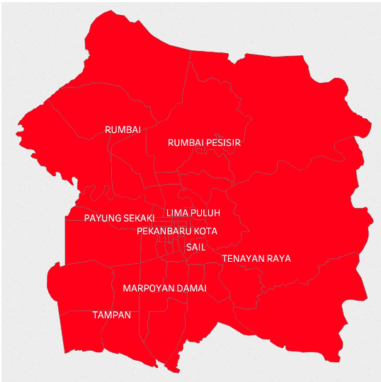 Figure: The model visualizes the movement of severe pollution across Pekanbaru districts.
Critical Insight & Conclusion
The true value of this work lies in its Inductive Bias—the assumption that the degradation of image quality in consumer photographs can be mathematically mapped to Air Quality Indices. While professional sensors are limited by infrastructure, "social sensors" (the public) are omnipresent.
Limitations: The method depends heavily on the volume of social media activity. In rural areas with low connectivity, the visual feature power may diminish. Furthermore, varying camera qualities across smartphones could introduce noise into the MSE/SSIM calculations.
Future Outlook: Integrating this into platforms like Haze Gazer demonstrates the transition from academic research to humanitarian tool. Future iterations might leverage more advanced Vision Transformers (ViT) to better extract haze patterns from complex urban textures.
Takeaway: In the age of AI, your social media feed isn't just for sharing—it's a distributed diagnostic tool for the planet.