
Beyond the Panic Button: Proactive Outdoor Monitoring via Mobile Social Networks
Outdoors Monitoring of Elderly People Assisted by Compass, GPS and Mobile Social Network
2009-01-01
Summary
Problem
Method
Results
Takeaways
Abstract
This paper presents an outdoor monitoring system for elderly care that integrates GPS and electronic compass data with a mobile social network framework. The core method, built on the "LibreGeoSocial" FLOSS infrastructure and early Android (HTC G1) hardware, enables real-time disorientation detection and proactive assistance through virtual community-based "active alarms."
## TL;DR
Researchers from Universidad Rey Juan Carlos have developed a system that moves past old-school "passive" emergency pendants. By combining **GPS**, **Compass sensors**, and a custom-built mobile social network called **LibreGeoSocial**, they've created an "Active Alarm" system. This setup doesn't wait for an elder to press a button; it detects disorientation automatically and provides a "Radar-like" visual guide to lead them home.
## The Shift from Passive to Active Care
For years, elderly monitoring was synonymous with "pendants"—simple wearable buttons. The problem? If someone is disoriented, panicked, or unconscious, they can't press the button. This represents a **Passive Alarm** model.
The authors argue for an **Active Alarm** paradigm. Using the then-emerging Android platform, they suggest that the smartphone shouldn't just be a phone; it should be a "context-aware guardian." The core challenge addressed is **outdoor disorientation**, where cognitive decline makes even familiar neighborhoods feel like a maze.
## Methodology: The LibreGeoSocial Backbone
The system's intelligence relies on two distinct layers:
### 1. The Mobile Social Infrastructure
Instead of a centralized server just sending SMS alerts, the authors use **LibreGeoSocial**, a FLOSS (Free Libre Open Source Software) framework. This treats the caregiver-elder relationship as a **Social Graph**. All nodes (people) are geo-located in real-time. This allows for:
* **Dynamic Perimeters**: Setting safety zones that can move or change.
* **Community Response**: Multiple caregivers can see the elder's location simultaneously on a REST-API-driven interface.
### 2. Sensor Fusion for Navigation
Standard maps (like Google Maps) often fail in parks, residential gardens, or areas with poor street data. To solve this, the authors synthesized GPS and Compass data.
* **The "Image Radar"**: If an elder wanders outside a perimeter, the phone doesn't just show a map; it shows a directional arrow (driven by the magnetometer) pointing precisely toward the caregiver or home.
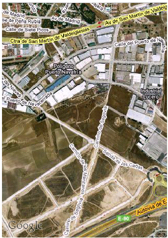
*Fig 1. (a) Geofence setup around the home; (b) Navigation in map-less areas.*
## Experiments & Use Cases
The paper details two critical scenarios that test the limits of mobile monitoring:
1. **The Static Perimeter**: Useful for elders living alone. An alarm triggers for the caregiver the moment the elder crosses a pre-defined boundary. Simultaneously, the elder's phone starts vibrating and displays a "Return Home" map.
2. **The Dynamic Follower**: Designed for residential group outings. Here, the "safe zone" is a relative distance from the caregiver. If the distance between the caregiver's phone and the elder's phone exceeds a threshold, an alarm triggers.
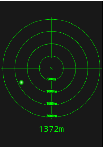
*Fig 2. The "Image Radar" UI (c) provides a simplified directional guide for users who find complex maps confusing.*
## Critical Insights & Future Outlook
While this work was a pioneer in utilizing the Android G1's sensor suite, it highlights a persistent hurdle in the field: **Battery Life**. Continuous GPS and Compass polling are energy-intensive.
**Takeaways for the Industry:**
* **Inductive Bias toward Simplicity**: The "Image Radar" is a brilliant UI choice for cognitive decline, stripping away the noise of a full map to provide a single, actionable direction.
* **Social Care over Centralized Care**: By embedding monitoring into a "social network," the system reduces the "clinical" feel of surveillance, making it a tool for family connectivity rather than just medical tracking.
**Future Directions**: The authors suggest integrating accelerometers for **Fall Detection** and vital sign monitors, moving toward a truly holistic "Ambient Intelligence." Looking back, this research was a clear precursor to the "Find My" and "Safety Check" features we see in modern smartphones today.