
Precise Digital Cities: Overcoming PLO Modeling Challenges with 3D Divergence Clustering
9009_Part-Based Modeling of Pole-Like Objects Using Divergence-Incorporated 3-D Clustering of Mobile Laser Scanning Point Clouds.
This paper introduces a part-based framework for extracting and modeling Pole-Like Objects (PLOs) from Mobile Laser Scanning (MLS) point clouds. The methodology integrates a Divergence-Incorporated 3-D Clustering algorithm for trunk detection and an Adaptive Growing strategy for canopy extraction, achieving high-precision SOTA modeling for 3-D digital cities.
Executive Summary: The "Digital Twins" of Urban Furniture
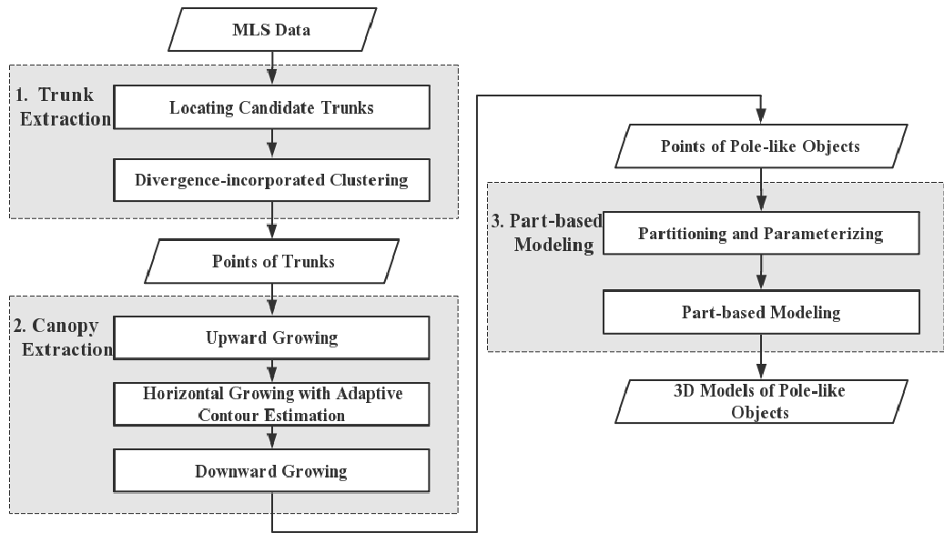
Building a vivid 3-D digital city requires more than just high-resolution building models; it necessitates the accurate capture of Pole-Like Objects (PLOs)—the trees, lamps, and traffic signs that define our urban corridors. This paper addresses a critical bottleneck in urban sensing: how to extract these objects accurately from noisy Mobile Laser Scanning (MLS) data and model them efficiently. The authors propose a "part-based" approach, separating trunks from canopies and using statistical divergence to filter out urban clutter like pedestrians and fences.
The "Littered" View: Why Traditional Methods Fail
Traditional PLO extraction usually relies on 2D density projections or simple geometric fits (like RANSAC cylinders). However, urban environments are messy:
- Interference: A pedestrian standing next to a wall or drooping leaves overhead can look like a "pole" in a 2D density map.
- Structural Gaps: Laser scanners often miss parts of a tree canopy due to occlusion or distance, causing region-growing algorithms to "stop" early and leave models incomplete.
- Efficiency vs. Vividness: Rendering millions of raw points is too slow, but simplified skeletons look unrealistic.
Methodology: The Core Innovations
1. Divergence-Incorporated 3D Clustering
Instead of looking at the points as just a mass, the authors treat the trunk extraction as a statistical problem. By using Kullback–Leibler (K-L) divergence, they compare the actual 3-D distribution of a point cluster against an "ideal" pole distribution.
- The Intuition: A real trunk is vertically continuous and predictable. A pedestrian or a shrub is irregular. The K-L divergence acts as a "filter" that effectively rejects anything that doesn't follow the specific information entropy of a cylinder.
2. Adaptive Growing Strategy
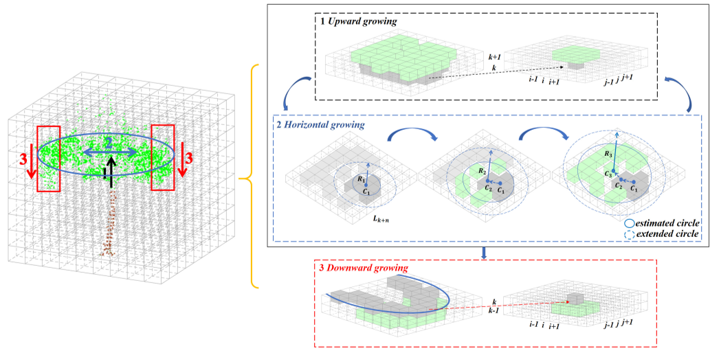
To handle the "gaps" in tree canopies, the paper introduces a three-phase growth mechanism:
- Upward: Vertical adjacency.
- Horizontal (with Contour Estimation): Instead of point-to-point adjacency, it calculates a weighted center and radius for each layer, allowing the algorithm to "leap" across empty voxels.
- Downward: Specifically designed to catch drooping branches that are physically disconnected from the upper trunk in the scan but part of the same biological structure.
Experimental Validation: Efficiency at Scale
The authors tested their system on three datasets, notably including the IQmulus TerraMobilita benchmark.
- Precision and Recall: The K-L divergence method achieved a precision of 98.45% in trunk extraction, significantly outperforming traditional 2D density-based methods (which suffered from 75.60% precision due to false positives like pedestrians).
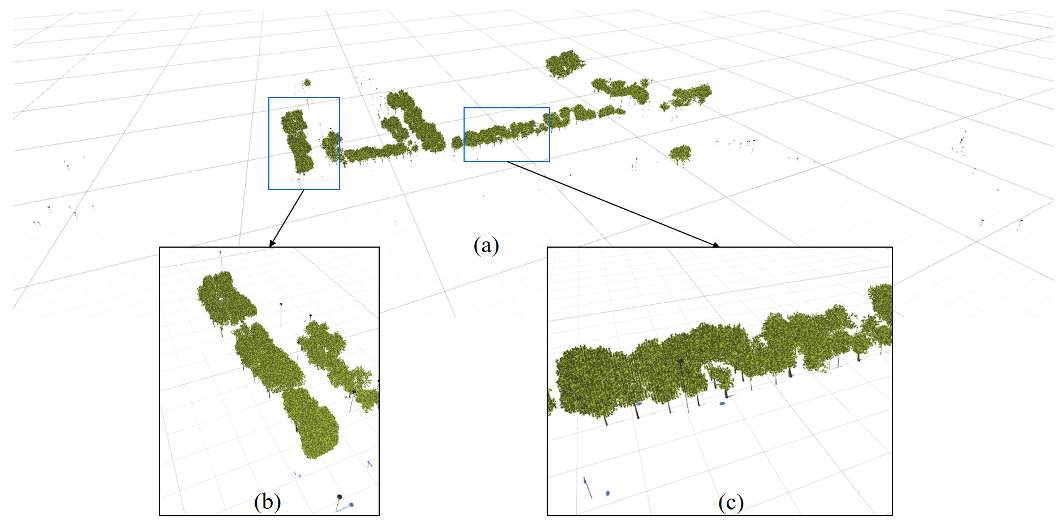
- Modeling Speed: By using voxelwise miniature models (replacing clusters of points with 3-D leaf/lamp primitives), the system could render a complex tree in as little as 0.011 seconds.
Deep Insight: Why Voxel-Based Modeling Matters
The most striking takeaway is the scalability. As point cloud density increases (e.g., from Dataset A to B), the total point count jumps by 39x, but the modeling time only increases by a factor of 1.35x. This is because the cost is tied to the voxelized representation rather than the raw point density, making this method perfectly suited for the massive datasets generated by modern high-end MLS systems like RIEGL.
Critical Analysis & Limitations
While the method is robust, it faces challenges in high-density occlusion. When street lamp canopies are intertwined with lush foliage, the algorithm may misidentify the lamp as part of the tree. The authors suggest that future work should incorporate multimodal data (like vehicle images) to resolve these semantic ambiguities.
Conclusion
This research provides a reliable framework for "cleaning" urban point clouds and transforming them into lightweight, vivid digital models. For civil engineers and urban planners, this represents a significant shift from raw data collection to actionable, efficient 3-D city management.