
Directing the Crowd: Push-Based Strategies to Solve the OpenStreetMap Tag Gap
Push-based Spatial Crowdsourcing for Enriching Semantic Tags in OpenStreetMap
This paper introduces a push-based spatial crowdsourcing framework designed to enrich semantic tags in OpenStreetMap (OSM). By formalizing the Maximum Road Segment Task Assignment (MRSTA) problem, the authors propose heuristic methods—specifically junction-based and road segment-based assignments—to maximize road network data collection while minimizing worker travel costs.
TL;DR
OpenStreetMap (OSM) is the "Wikipedia of maps," but it's riddled with missing data. This paper proposes a "push" system that actively assigns specific road segments to contributors. By grouping tasks at road junctions, the researchers increased data collection throughput by 5x while actually reducing the travel effort required by volunteers.
Background: The Invisible Map
While OSM is a triumph of community effort, its data is surprisingly thin. Even basic attributes like "Name" are missing for over 70% of segments globally. The fundamental issue is discovery: amateur cartographers don't know where their contributions are most needed. Most existing spatial crowdsourcing tools treat tasks as isolated points, failing to capitalize on the fact that roads are connected in a network.
The Core Insight: Junctions as Force Multipliers
The authors' breakthrough lies in changing the unit of work. Instead of asking a worker to visit a single road segment, why not send them to a junction?
In a typical urban grid, one junction connects four road segments. By reaching one physical location, a worker can verify tags for all four segments. This mathematical intuition transforms the problem from a simple matching game into a network optimization challenge.
Methodology: Assigning Tasks at Scale
The paper formalizes the Maximum Road Segment Task Assignment (MRSTA) problem and tackles it through three primary algorithms:
- Max Flow-based Task Grouping (TG): It models the assignment as a flow network where capacity constraints represent worker availability and travel limits.
- Direct Assignment with Road Segments (DA-RS): A heuristic that matches workers to the nearest individual segments.
- Direct Assignment with Junctions (DA-J): The most effective method, which prioritizes sending workers to high-degree nodes (intersections) within their travel radius.
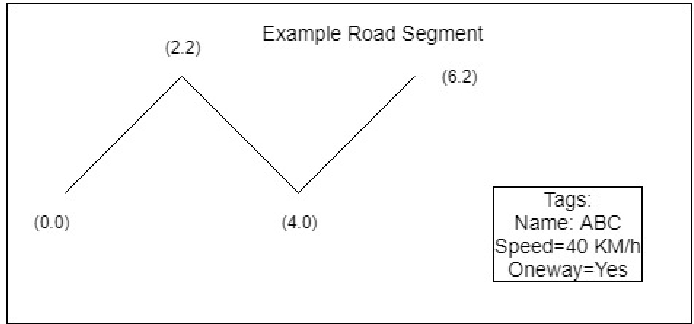 Figure: The transition from individual road tasks (a) to junction-based grouping (b).
Experimental Results: Efficiency Reimagined
Using real-world data from Aalborg, Denmark (17,503 segments), the authors compared their heuristics against standard "Greedy" and "Nearest Neighbor" baselines.
- Throughput: The Junction-based approach (DA-J) assigned five times more tasks than the baseline greedy method.
- Travel cost: Despite assigning more tasks, the average travel distance per task dropped by 35%. This is a rare "win-win" in optimization—more work done with less physical effort.
- Scalability: The algorithms remained efficient even as the simulated worker pool grew from 1,000 to 50,000 participants.
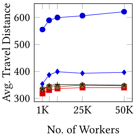 Figure: The DA-J method shows a massive lead in assignment volume (left) while maintaining lower average travel costs (right).
Critical Perspective & Future Work
The achievement of a 5x improvement is significant, but a few hurdles remain:
- Worker Motivation: The paper focuses on the assignment (the "Push"), but not the incentive. Why would a volunteer follow the server's orders instead of mapping their own neighborhood?
- Dynamic Nature: Road networks change. While the paper mentions temporal aspects, the current model works best for static semantic tags rather than real-time traffic updates.
Takeaway: For any spatial crowdsourcing project—whether it's mapping, delivery, or urban maintenance—the topology of the environment matters. By grouping tasks at natural convergence points (junctions), we can turn a sparse voluntary effort into a high-precision data engine.