
Breaking the Global Bottleneck: How Adaptive Modeling Redefines Chlorophyll-a Retrieval
Regionally and Locally Adaptive Models for Retrieving Chlorophyll-a Concentration in Inland Waters From Remotely Sensed Multispectral and Hyperspectral Imagery
This paper introduces regionally and locally adaptive empirical models for retrieving Chlorophyll-a (Chl-a) concentrations in optically complex inland waters (Case 2 waters). By replacing single "global" models with geographically weighted regression approaches, the authors achieved Chl-a estimation accuracy improvements of up to 28% for Sentinel-2 multispectral data and 47% for airborne hyperspectral imagery.
TL;DR
Monitoring algal blooms in inland waters has long been plagued by the "Global Model" fallacy—the idea that one equation fits an entire lake. Researchers have now demonstrated that by using Regionally and Locally Adaptive Models, we can boost retrieval accuracy for Chlorophyll-a (Chl-a) by nearly 50% using Sentinel-2 and airborne hyperspectral data.
The Spatial Autocorrelation Sinkhole
In remote sensing, we often use empirical band ratios (like the red/near-infrared 2BDA) to track Chl-a. Traditionally, scientists calibrate one "Global Model" for a whole study area. But inland lakes are complicated "Case 2" waters.
The authors of this study discovered a critical flaw in the global approach: Spatial Autocorrelation of Errors. When they mapped the residuals of their models, they found clusters. The global model consistently overpredicted Chl-a in the clear west basin of Harsha Lake and underpredicted it in the turbid east basin. The culprit? Spatial heterogeneity in suspended sediments, dissolved organic matter (CDOM), and bathymetry that a single slope and intercept simply cannot capture.
The Strategy: Localizing the Math
To solve this, the team moved away from the "one-size-fits-all" philosophy and introduced two layers of adaptation:
- Regionally Adaptive Models: They split Harsha Lake into its natural hydrologic divisions (West and East basins), training separate models for each.
- Locally Adaptive Models: Using kernel regression, they established a moving-window approach. For any given pixel, the model is calibrated using only the nearest in-situ sampling sites.
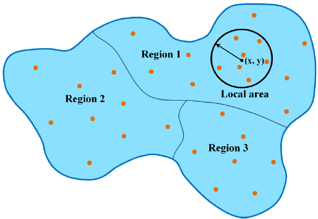 Figure: The transition from a single global fit to localized geographic units.
Methodology Highlights
- Sensors: Comparison between Sentinel-2A MSI (10m-60m resolution) and NASA's HSI2 airborne hyperspectral imager (1.2m resolution).
- Algorithms: Tested 2BDA, 3BDA, NDCI, and several others. The Two-Band Algorithm (2BDA) emerged as the most robust baseline.
- Atmospheric Correction: A crucial finding showed that while the ESA's Sen2Cor is standard for Sentinel-2, the Empirical Line Method (ELM) and QUAC outperformed it in these specific aquatic conditions.
Results: The Power of Proximity
The results were striking. By simply allowing the model to adapt its parameters to the local environment, the error (RMSE) plummeted:
- Sentinel-2 Multispectral: 28% improvement in accuracy.
- Airborne Hyperspectral: 47% improvement in accuracy.
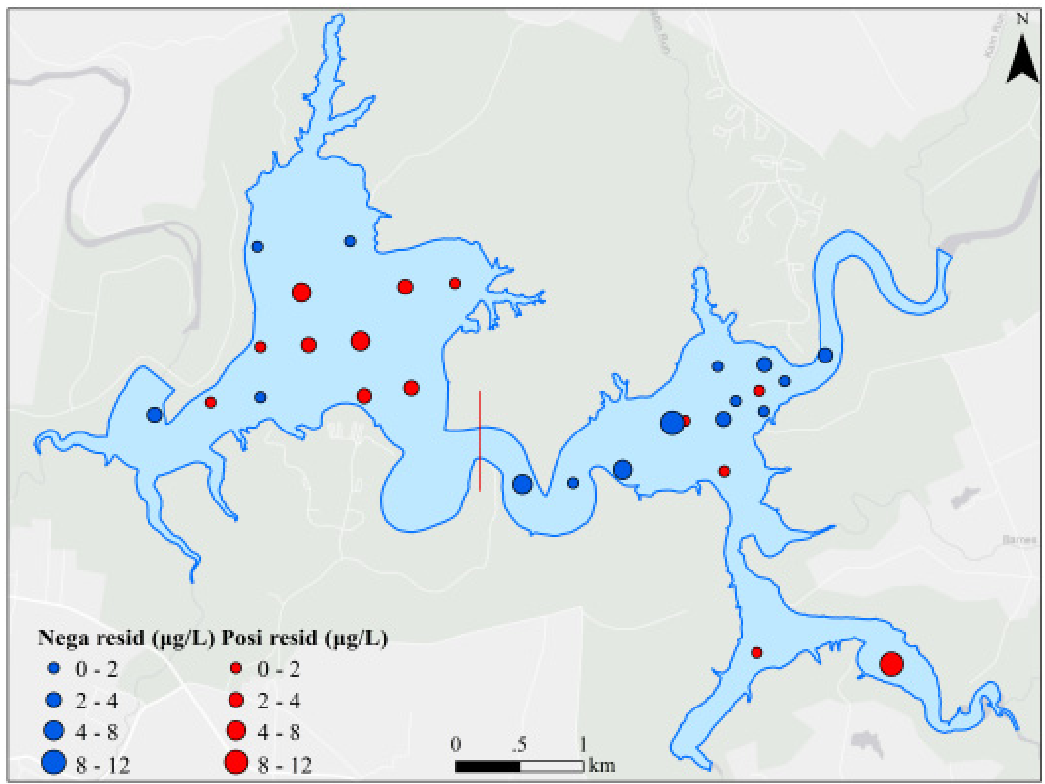 Figure: Comparison of Chl-a distribution maps. Notice how the locally adaptive model (c) provides a much more nuanced depiction of nutrient-rich river mouths.
Critical Insights & Future Outlook
The key takeaway is that homogeneity is a relative concept. By subdividing a lake into smaller spatial units, we increase the internal homogeneity of each unit, allowing simpler linear models to perform with surgical precision.
However, there is a trade-off: Data Density. Adaptive models are hungry for ground-truth data. You cannot run a locally adaptive model without a dense net of in-situ sampling sites. For massive, under-sampled regions, regional adaptation remains the practical sweet spot.
This research signals a shift for environmental agencies. Moving forward, the "Global Algorithm" will likely be replaced by Geographically Weighted Frameworks, where remote sensing models "learn" the local optical signature of every cove and inlet.
Limitations
- Requires high-density in-situ measurements, which are expensive.
- Local models are sensitive to the chosen kernel size (number of neighboring points).
Conclusion
By accounting for the spatial "personality" of different water zones, Xu et al. have provided a blueprint for more reliable algal bloom monitoring. As Sentinel-2B joins its twin in orbit, these adaptive frameworks could become the standard for real-time water quality risk management.