
QuinJunSAT: Bridging Satellites and Citizens for Hybrid Crisis Resilience
Satellite Imagery and On-Site Crowdsourcing for Improved Crisis Resilience
The paper introduces QuinJunSAT, a crisis management system that fuses Very High-Resolution (VHR) Earth Observation (EO) satellite imagery with on-site crowdsourcing via crowdtasking. By combining automated satellite change detection with real-time ground verification from citizens, the system creates a high-fidelity Common Operational Picture (COP) for disaster response.
TL;DR
In the wake of a natural disaster, the difference between life and death often hinges on the speed and accuracy of the "Common Operational Picture." This paper unveils QuinJunSAT, a revolutionary framework that marries the "eye in the sky" (Satellite Earth Observation) with "boots on the ground" (Mobile Crowdsourcing). By using satellites to find potential damage and citizens to verify it, the system creates a resilient, actionable intelligence loop for first responders.
The Information Gap: Why Satellites or People Aren't Enough
Disaster management typically relies on two separate silos:
- Earth Observation (EO): Reliable and broad, but lacks granularity. A satellite might see a "collapsed roof," but it can't tell if it's a critical hospital or an abandoned warehouse, nor can it see through the clouds.
- Crowdsourcing: Near real-time and context-rich, but chaotic. Reports from the public are often biased, geographically clustered, or contradictory.
The authors argue that the solution lies in fusion. We need the satellite to tell us where to look and the crowd to tell us what they see.
Methodology: The QuinJunSAT Architecture
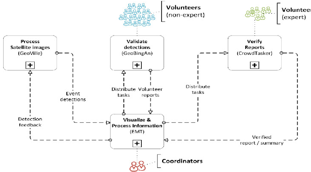
The system is built on a semi-automated workflow that moves from macro-analysis to micro-verification.
1. The Rapid Assessment System (REA)
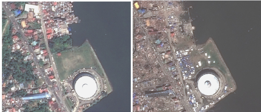
Instead of simple pixel-based analysis, QuinJunSAT uses Object-Based Image Analysis (OBIA). This mimics human vision by grouping pixels into meaningful objects (buildings, bridges, roads) and detecting changes between pre- and post-event imagery.
2. Targeted Crowdtasking
Once the REA detects a "change polygon" (indicating potential damage), the system generates a Crowdtask. This is sent via the geoBingAn app to volunteers near the location. They are asked specific questions: "Is the bridge at these coordinates passable?" or "What is the construction material of this collapsed structure?"
3. The Two-Tier Verification Loop
To combat the "noise" of crowdsourcing, the system employs a two-level hierarchy:
- Level 1 (Direct Response): General volunteers provide the bulk of photos and reports.
- Level 2 (Expert Review): If reports are contradictory (e.g., three say "Yes," three say "No"), expert volunteers are dispatched via CrowdTasker to provide a final, high-fidelity verdict.
Field Test: Putting the System to the Test in Taiwan
The system was deployed during the 921 International Disaster Prevention Drill in Hsinchu, Taiwan—a region prone to high-seismic activity.
 In the drill, Pléiades satellite imagery (0.5m resolution) was analyzed to identify urban changes, which then triggered volunteer tasks.
Real-World Evidence
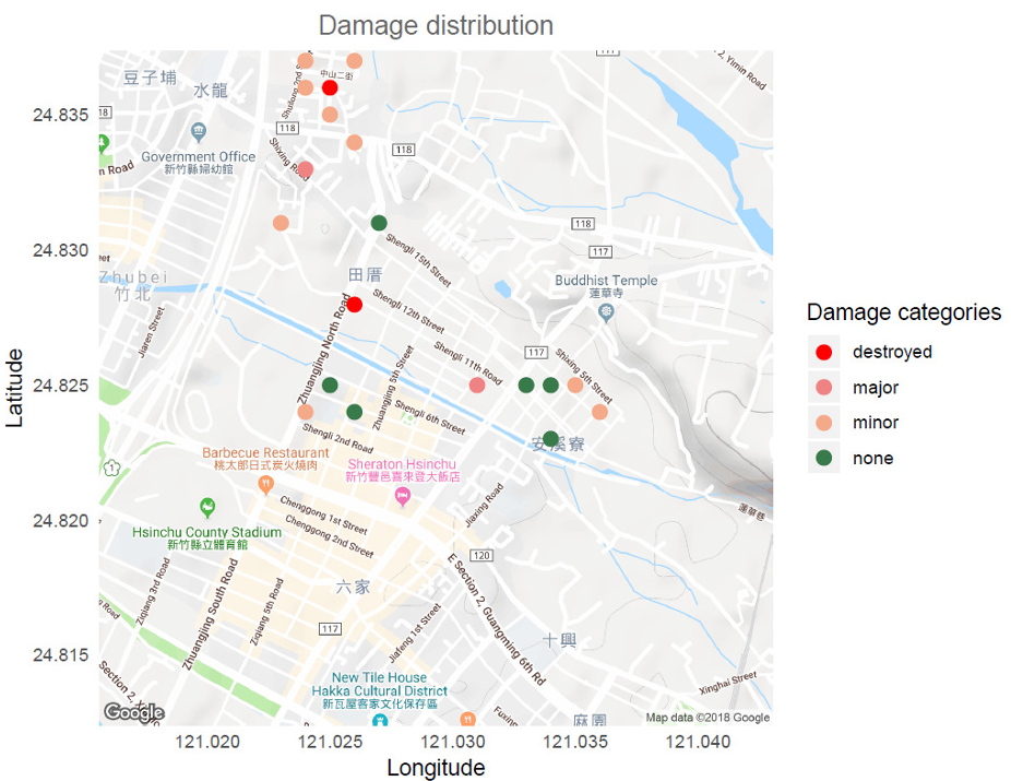
In the field, crisis managers at the fire bureau used the Emergency Maps Tool (EMT) to visualize both the satellite damage markers (red polygons) and the incoming ground reports. This correlation allowed for the identification of "hotspots" where satellite data and human reports confirmed high-priority damage.
Critical Insight & Future Outlook
While the QuinJunSAT approach significantly improves Actionability, several hurdles remain:
- The Temporal Gap: Satellites currently have a "revisit time" (often once per day). If the disaster happens right after a pass, we wait 24 hours. The authors point to new "Satellite Constellations" as the fix.
- Volunteer Retention: Crowdsourcing is only as strong as its community. Without incentives or professionalized volunteer teams, data volume drops.
- Safety First: A critical ethical consideration is the safety of the "human sensor." Redirecting citizens into disaster zones to "verify damage" requires robust geofencing and safety protocols.
Conclusion
QuinJunSAT proves that the future of crisis resilience isn't just about better sensors or smarter AI—it's about the intelligent orchestration of both. By treating citizens not just as victims to be saved, but as active nodes in a sensing network, we can build a much more robust defense against the increasing frequency of climate-driven disasters.
Takeaway: Effective CDM (Crisis and Disaster Management) requires a "Human-In-The-Loop" approach where automated EO detection acts as the trigger and human intuition acts as the filter.