
Digital Flag-Planting: How We Claim Physical Territory Through Social Media
Unfolding the interplay of self-identity and expressions of territoriality in location-based social networks
This paper explores the interplay between self-identity and expressions of territoriality in Location-Based Social Networks (LBSN) through a six-week study of a custom-built application called GeoMoments. The study identifies how users non-verbally "claim" physical territories by clustering digital posts to curate their "spatial self" and manage social impressions.
TL;DR
Why do we feel a sense of ownership over the Starbucks we frequent or the park across from our house? This paper investigates GeoMoments, a custom Location-Based Social Network (LBSN), to reveal that our digital check-ins are more than just "updates"—they are tools for territoriality. Users "claim" areas by flooding them with posts to establish themselves as "locals," leading to digital "wars" and social friction when others try to "steal" their spots.
The "Spatial Self": More Than Just a Pin on a Map
In the world of LBSNs, we often talk about where people are, but rarely why they want us to know they are there. Traditional research has looked at "Impression Management"—the idea that we post things to look "cool."
However, the authors of this study argue that there is a deeper, more primitive drive at play: Territoriality. As we blend our physical and digital lives (a concept called "Net Locality"), our geocoded traces become a way to project power and claim ownership over physical spaces. The problem is that current apps like Google Maps or Foursquare don't explicitly design for this "perceived power," leading to unexpected user behaviors and conflicts.
Methodology: The GeoMoments Experiment
To study this, researchers developed GeoMoments, an app allowing users to post "Moments" (text or photos) at their current location. Because global services like Google Maps face restrictions in China, a custom-built solution was necessary to observe 42 participants over six weeks in Suzhou.
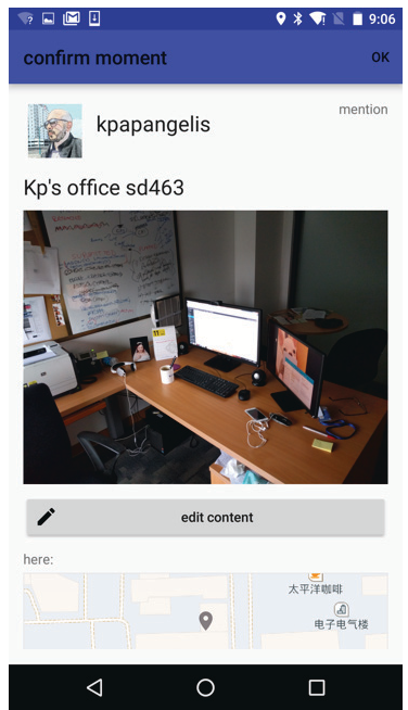 Figure: The GeoMoments interface allows users to manage their digital traces and interact with others in their proximity.
The Core Insight: Digital "Moment Wars"
The findings were striking. Users didn't just post randomly; they engaged in a sophisticated dance of Identity Negotiation and Territorial Defense:
- The "Local" Identity: Users clustered posts in specific areas (like a neighborhood or a mall) to "claim" them. The goal was to ensure everyone knew they were the "locals" of that area.
- Territorial Friction: When a new user started posting in a "claimed" area, original "owners" felt threatened. One participant expressed frustration when "K" started posting at a mall where he had 21 posts: "She thinks she is better than me."
- The Concept of "Theft": Over 38% of participants used words like "steal" to describe others posting in their zones. This suggests that digital presence confers a hierarchical position—a perceived right to occupy a space that others can supposedly take away.
- Defense Mechanisms: Some users went to extremes, even posting "No Moment Zone" signs to warn others away from their digital territory.
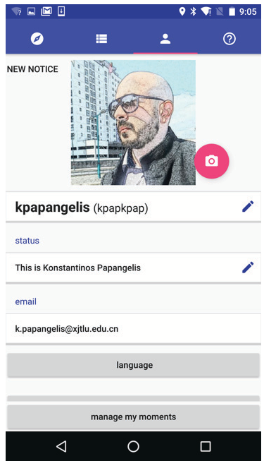 Figure: Public profiles and the ability to tag others created a "potential for surveillance" that affirmed user identity.
Why This Matters: Design Implications
The study concludes that LBSNs are not just social tools—they are catalysts for urban interaction and power dynamics. The authors suggest three key design pivots for future tech:
- Articulate Claims: Allow users to explicitly claim an area's identity (e.g., "The Mayor" or "Local Resident").
- Power Dynamics: Recognize that "owning" an area in an app creates real-world social value.
- Identity Control: Give users better tools to perform or hide specific aspects of their identity based on the location's context.
Critical Analysis & Conclusion
This work provides a fascinating lens into the Hybridity of our lives. It proves that the "Body" is still central to digital identity; where we physically stand—and where we say we stand—defines who we are to society.
Limitations: The study was conducted with a relatively small group (42 people) in a specific cultural context (Suzhou, China). Group dynamics might vary significantly in Western or more rural environments.
Takeaway: In the future, "claiming a spot" on a map might carry as much social weight as owning a piece of real estate. LBSN developers must decide: will they design for cooperation, or will they fuel the digital "moment wars"?