
Decoding the City Core: Modeling Urban Dynamics via Digital Footprints
13123_Urban Computing and Smart Cities Opportunities and Challenges in Modelling Large-Scale Aggregated Human Behavior.
This paper explores the intersection of Urban Computing and Smart Cities, focusing on modeling large-scale human behavior using pervasive digital footprints like mobile phone records and shared bicycle data. The author demonstrates how clustering and pattern recognition can automatically identify urban hotspots and segment city areas by behavioral profiles to inform urban planning and public health.
TL;DR
This work addresses the transition from traditional, static survey-based urban planning to dynamic, data-driven Urban Computing. By analyzing anonymized cell-phone records and shared bicycling data, the research provides a framework for automatically segmenting cities into behavioral zones and identifying activity hotspots in real-time.
Background & Positioning
As urban environments become increasingly digitized, they leave behind "digital footprints." Nuria Oliver’s work positions itself at the intersection of Sociology, Computer Science, and Urban Planning. Rather than viewing the city as a collection of static buildings, this paper treats it as a living organism whose state can be inferred through the ubiquitous sensors we carry in our pockets.
The Problem: The Failure of Static Surveys
For decades, urban planners relied on census data and physical surveys. These methods suffer from four critical bottlenecks:
- Complexity/Cost: Collecting manual surveys is prohibitively expensive.
- Low Granularity: Data is often too aggregated to show street-level dynamics.
- Temporal Stagnation: Surveys are snapshots; they cannot capture how a city changes from 8 AM to 8 PM.
- Privacy Resistance: Individuals are increasingly reluctant to provide personal data to researchers.
Methodology: Clustering the Pulse of the City
The core innovation lies in using Clustering Algorithms to process two specific data streams:
- Shared Bicycling Stations: Using pick-up and drop-off patterns to identify commercial vs. residential rhythms.
- Anonymized Cell-Phone Records: Leveraging signal density to map human density and mobility.
The method doesn't just look at where people are, but how the behavior of an area correlates with others. If two distinct geographical areas show the same temporal patterns of activity, they are clustered into the same "functional zone."
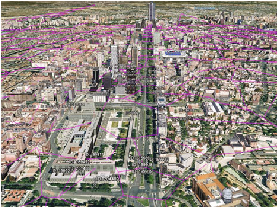 Figure 1: Automatic segmentation of city areas based on behavioral similarity. Areas with similar temporal signatures are clustered, enabling planners to see "hidden" relationships between districts.
Key Insights & Applications
The ability to automatically define "Hotspots" and segments has immediate, high-impact applications:
- Public Health: Identifying high-density interaction zones where biological viruses are likely to spread fastest.
- Infrastructure Optimization: Detecting "underserved" dense areas where public transport capacity does not match actual human presence.
- Dynamic Urban Design: Moving from rigid zoning (Residential/Commercial) to dynamic zoning based on actual usage.
Critical Analysis & Future Outlook
While the paper demonstrates the power of aggregated data, it acknowledges the massive challenges in Privacy and Security. As we move toward 2026 and beyond, the "Human-Centric" aspect of Smart Cities must evolve to ensure that while the city learns from its citizens, it also protects their anonymity.
The transition from Sensing the city to Predicting the city is the next frontier. This work provides the foundational clustering logic required to turn raw signal noise into actionable urban intelligence.
Conclusion
Nuria Oliver’s research proves that the city is no longer a "black box." By leveraging the technologies we use every day, we can build urban environments that are more responsive, efficient, and ultimately, more human.